You are here: Home > Network List > TA - USArray Transportable Network (new EarthScope stations) Stations List
> Station O29A 4D Ranch, Culbertson, NE, USA > Earthquake Result Viewer
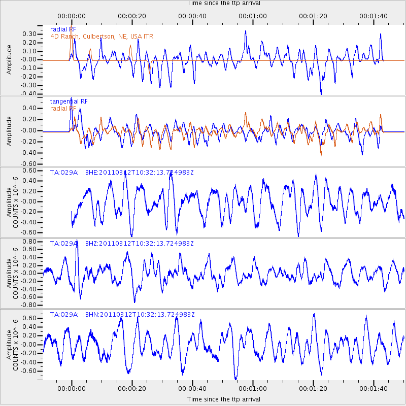
O29A 4D Ranch, Culbertson, NE, USA - Earthquake Result Viewer
*The percent match for this event was below the threshold and hence no stack was calculated.
| Earthquake location: |
Off East Coast Of Honshu, Japan |
| Earthquake latitude/longitude: |
37.2/143.5 |
| Earthquake time(UTC): |
2011/03/12 (071) 10:20:21 GMT |
| Earthquake Depth: |
22 km |
| Earthquake Magnitude: |
5.5 MB, 5.3 MW |
| Earthquake Catalog/Contributor: |
WHDF/NEIC |
|
| Network: |
TA USArray Transportable Network (new EarthScope stations) |
| Station: |
O29A 4D Ranch, Culbertson, NE, USA |
| Lat/Lon: |
40.13 N/100.80 W |
| Elevation: |
826 m |
|
| Distance: |
83.1 deg |
| Az: |
44.087 deg |
| Baz: |
313.532 deg |
| Ray Param: |
$rayparam |
*The percent match for this event was below the threshold and hence was not used in the summary stack. |
|
| Radial Match: |
54.116043 % |
| Radial Bump: |
400 |
| Transverse Match: |
65.04644 % |
| Transverse Bump: |
400 |
| SOD ConfigId: |
356183 |
| Insert Time: |
2011-08-19 17:14:05.780 +0000 |
| GWidth: |
2.5 |
| Max Bumps: |
400 |
| Tol: |
0.001 |
|
Signal To Noise
| Channel | StoN | STA | LTA |
| TA:O29A: :BHZ:20110312T10:32:13.724983Z | 3.210257 | 3.898503E-7 | 1.2143896E-7 |
| TA:O29A: :BHN:20110312T10:32:13.724983Z | 1.004699 | 2.1269868E-7 | 2.1170388E-7 |
| TA:O29A: :BHE:20110312T10:32:13.724983Z | 1.2921437 | 3.5369743E-7 | 2.737292E-7 |
| Arrivals |
| Ps | |
| PpPs | |
| PsPs/PpSs | |


