You are here: Home > Network List > TA - USArray Transportable Network (new EarthScope stations) Stations List
> Station X39A Fountain Ranch, Mena, AR, USA > Earthquake Result Viewer
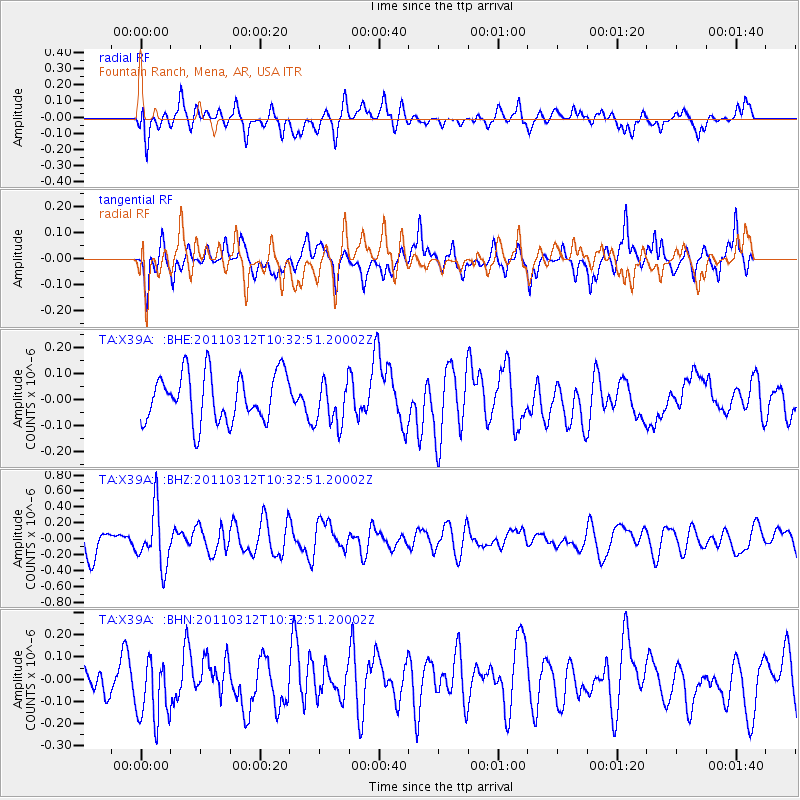
X39A Fountain Ranch, Mena, AR, USA - Earthquake Result Viewer
*The percent match for this event was below the threshold and hence no stack was calculated.
| Earthquake location: |
Off East Coast Of Honshu, Japan |
| Earthquake latitude/longitude: |
37.2/143.5 |
| Earthquake time(UTC): |
2011/03/12 (071) 10:20:21 GMT |
| Earthquake Depth: |
22 km |
| Earthquake Magnitude: |
5.5 MB, 5.3 MW |
| Earthquake Catalog/Contributor: |
WHDF/NEIC |
|
| Network: |
TA USArray Transportable Network (new EarthScope stations) |
| Station: |
X39A Fountain Ranch, Mena, AR, USA |
| Lat/Lon: |
34.51 N/94.11 W |
| Elevation: |
326 m |
|
| Distance: |
90.8 deg |
| Az: |
44.201 deg |
| Baz: |
317.58 deg |
| Ray Param: |
$rayparam |
*The percent match for this event was below the threshold and hence was not used in the summary stack. |
|
| Radial Match: |
62.470463 % |
| Radial Bump: |
400 |
| Transverse Match: |
55.62756 % |
| Transverse Bump: |
291 |
| SOD ConfigId: |
356183 |
| Insert Time: |
2011-08-19 17:49:00.661 +0000 |
| GWidth: |
2.5 |
| Max Bumps: |
400 |
| Tol: |
0.001 |
|
Signal To Noise
| Channel | StoN | STA | LTA |
| TA:X39A: :BHZ:20110312T10:32:51.20002Z | 2.4105334 | 3.5748874E-7 | 1.4830276E-7 |
| TA:X39A: :BHN:20110312T10:32:51.20002Z | 1.3082523 | 1.502923E-7 | 1.14880216E-7 |
| TA:X39A: :BHE:20110312T10:32:51.20002Z | 0.9367524 | 8.6358305E-8 | 9.218904E-8 |
| Arrivals |
| Ps | |
| PpPs | |
| PsPs/PpSs | |


