You are here: Home > Network List > AZ - ANZA Regional Network Stations List
> Station SMER AZ.SMER > Earthquake Result Viewer
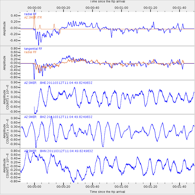
SMER AZ.SMER - Earthquake Result Viewer
*The percent match for this event was below the threshold and hence no stack was calculated.
| Earthquake location: |
Near East Coast Of Honshu, Japan |
| Earthquake latitude/longitude: |
39.0/142.3 |
| Earthquake time(UTC): |
2011/03/12 (071) 10:53:30 GMT |
| Earthquake Depth: |
27 km |
| Earthquake Magnitude: |
6.0 MB, 5.4 MS, 5.7 MW, 5.7 MW |
| Earthquake Catalog/Contributor: |
WHDF/NEIC |
|
| Network: |
AZ ANZA Regional Network |
| Station: |
SMER AZ.SMER |
| Lat/Lon: |
33.46 N/117.17 W |
| Elevation: |
355 m |
|
| Distance: |
77.0 deg |
| Az: |
57.512 deg |
| Baz: |
308.217 deg |
| Ray Param: |
$rayparam |
*The percent match for this event was below the threshold and hence was not used in the summary stack. |
|
| Radial Match: |
73.55582 % |
| Radial Bump: |
400 |
| Transverse Match: |
52.27508 % |
| Transverse Bump: |
400 |
| SOD ConfigId: |
356183 |
| Insert Time: |
2011-08-19 18:15:52.563 +0000 |
| GWidth: |
2.5 |
| Max Bumps: |
400 |
| Tol: |
0.001 |
|
Signal To Noise
| Channel | StoN | STA | LTA |
| AZ:SMER: :BHZ:20110312T11:04:49.824983Z | 1.2444123 | 5.051176E-7 | 4.0590857E-7 |
| AZ:SMER: :BHN:20110312T11:04:49.824983Z | 1.278252 | 9.3569406E-7 | 7.320107E-7 |
| AZ:SMER: :BHE:20110312T11:04:49.824983Z | 1.0488173 | 4.2578512E-7 | 4.059669E-7 |
| Arrivals |
| Ps | |
| PpPs | |
| PsPs/PpSs | |


