You are here: Home > Network List > TA - USArray Transportable Network (new EarthScope stations) Stations List
> Station D28A Regan, ND, USA > Earthquake Result Viewer
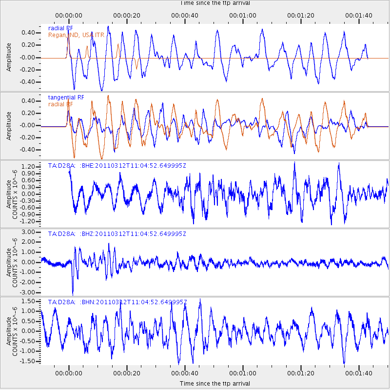
D28A Regan, ND, USA - Earthquake Result Viewer
*The percent match for this event was below the threshold and hence no stack was calculated.
| Earthquake location: |
Near East Coast Of Honshu, Japan |
| Earthquake latitude/longitude: |
39.0/142.3 |
| Earthquake time(UTC): |
2011/03/12 (071) 10:53:30 GMT |
| Earthquake Depth: |
27 km |
| Earthquake Magnitude: |
6.0 MB, 5.4 MS, 5.7 MW, 5.7 MW |
| Earthquake Catalog/Contributor: |
WHDF/NEIC |
|
| Network: |
TA USArray Transportable Network (new EarthScope stations) |
| Station: |
D28A Regan, ND, USA |
| Lat/Lon: |
47.19 N/100.57 W |
| Elevation: |
621 m |
|
| Distance: |
77.5 deg |
| Az: |
38.432 deg |
| Baz: |
314.789 deg |
| Ray Param: |
$rayparam |
*The percent match for this event was below the threshold and hence was not used in the summary stack. |
|
| Radial Match: |
58.468697 % |
| Radial Bump: |
400 |
| Transverse Match: |
65.22341 % |
| Transverse Bump: |
400 |
| SOD ConfigId: |
356183 |
| Insert Time: |
2011-08-19 19:16:48.529 +0000 |
| GWidth: |
2.5 |
| Max Bumps: |
400 |
| Tol: |
0.001 |
|
Signal To Noise
| Channel | StoN | STA | LTA |
| TA:D28A: :BHZ:20110312T11:04:52.649995Z | 4.284767 | 1.0592795E-6 | 2.4721984E-7 |
| TA:D28A: :BHN:20110312T11:04:52.649995Z | 0.46517506 | 3.1828688E-7 | 6.8423026E-7 |
| TA:D28A: :BHE:20110312T11:04:52.649995Z | 1.1222576 | 4.5529276E-7 | 4.0569364E-7 |
| Arrivals |
| Ps | |
| PpPs | |
| PsPs/PpSs | |


