You are here: Home > Network List > TA - USArray Transportable Network (new EarthScope stations) Stations List
> Station E28A Huff, ND, USA > Earthquake Result Viewer
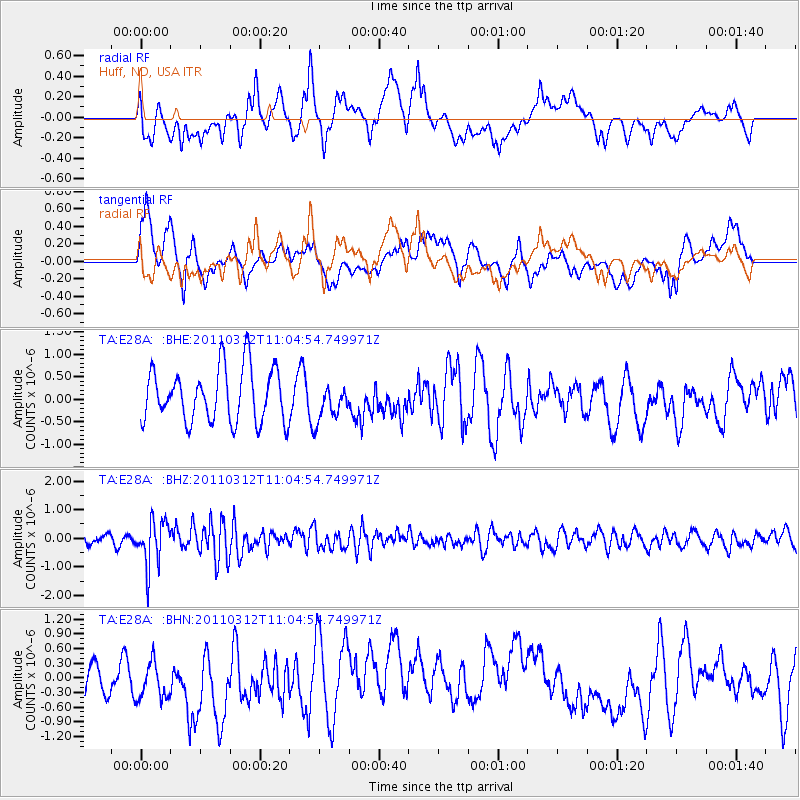
E28A Huff, ND, USA - Earthquake Result Viewer
*The percent match for this event was below the threshold and hence no stack was calculated.
| Earthquake location: |
Near East Coast Of Honshu, Japan |
| Earthquake latitude/longitude: |
39.0/142.3 |
| Earthquake time(UTC): |
2011/03/12 (071) 10:53:30 GMT |
| Earthquake Depth: |
27 km |
| Earthquake Magnitude: |
6.0 MB, 5.4 MS, 5.7 MW, 5.7 MW |
| Earthquake Catalog/Contributor: |
WHDF/NEIC |
|
| Network: |
TA USArray Transportable Network (new EarthScope stations) |
| Station: |
E28A Huff, ND, USA |
| Lat/Lon: |
46.57 N/100.69 W |
| Elevation: |
579 m |
|
| Distance: |
77.9 deg |
| Az: |
38.942 deg |
| Baz: |
314.808 deg |
| Ray Param: |
$rayparam |
*The percent match for this event was below the threshold and hence was not used in the summary stack. |
|
| Radial Match: |
57.046757 % |
| Radial Bump: |
400 |
| Transverse Match: |
48.722385 % |
| Transverse Bump: |
400 |
| SOD ConfigId: |
356183 |
| Insert Time: |
2011-08-19 19:19:27.207 +0000 |
| GWidth: |
2.5 |
| Max Bumps: |
400 |
| Tol: |
0.001 |
|
Signal To Noise
| Channel | StoN | STA | LTA |
| TA:E28A: :BHZ:20110312T11:04:54.749971Z | 2.7140522 | 7.95944E-7 | 2.9326776E-7 |
| TA:E28A: :BHN:20110312T11:04:54.749971Z | 0.8635883 | 4.4463613E-7 | 5.148705E-7 |
| TA:E28A: :BHE:20110312T11:04:54.749971Z | 0.6710973 | 3.983511E-7 | 5.935817E-7 |
| Arrivals |
| Ps | |
| PpPs | |
| PsPs/PpSs | |


