You are here: Home > Network List > TA - USArray Transportable Network (new EarthScope stations) Stations List
> Station 634A China Grove, San Antonio TX, USA > Earthquake Result Viewer
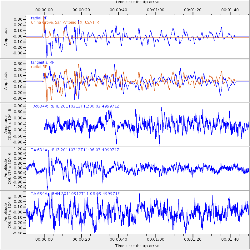
634A China Grove, San Antonio TX, USA - Earthquake Result Viewer
*The percent match for this event was below the threshold and hence no stack was calculated.
| Earthquake location: |
Near East Coast Of Honshu, Japan |
| Earthquake latitude/longitude: |
39.0/142.3 |
| Earthquake time(UTC): |
2011/03/12 (071) 10:53:30 GMT |
| Earthquake Depth: |
27 km |
| Earthquake Magnitude: |
6.0 MB, 5.4 MS, 5.7 MW, 5.7 MW |
| Earthquake Catalog/Contributor: |
WHDF/NEIC |
|
| Network: |
TA USArray Transportable Network (new EarthScope stations) |
| Station: |
634A China Grove, San Antonio TX, USA |
| Lat/Lon: |
29.38 N/98.35 W |
| Elevation: |
188 m |
|
| Distance: |
91.5 deg |
| Az: |
49.542 deg |
| Baz: |
317.247 deg |
| Ray Param: |
$rayparam |
*The percent match for this event was below the threshold and hence was not used in the summary stack. |
|
| Radial Match: |
73.33397 % |
| Radial Bump: |
400 |
| Transverse Match: |
55.945126 % |
| Transverse Bump: |
400 |
| SOD ConfigId: |
356183 |
| Insert Time: |
2011-08-19 19:38:36.467 +0000 |
| GWidth: |
2.5 |
| Max Bumps: |
400 |
| Tol: |
0.001 |
|
Signal To Noise
| Channel | StoN | STA | LTA |
| TA:634A: :BHZ:20110312T11:06:03.499971Z | 3.6201086 | 5.0955185E-7 | 1.4075596E-7 |
| TA:634A: :BHN:20110312T11:06:03.499971Z | 2.3539815 | 1.9527887E-7 | 8.2956845E-8 |
| TA:634A: :BHE:20110312T11:06:03.499971Z | 1.5075213 | 2.9147125E-7 | 1.9334472E-7 |
| Arrivals |
| Ps | |
| PpPs | |
| PsPs/PpSs | |


