You are here: Home > Network List > TA - USArray Transportable Network (new EarthScope stations) Stations List
> Station J33A Davis, SD, USA > Earthquake Result Viewer
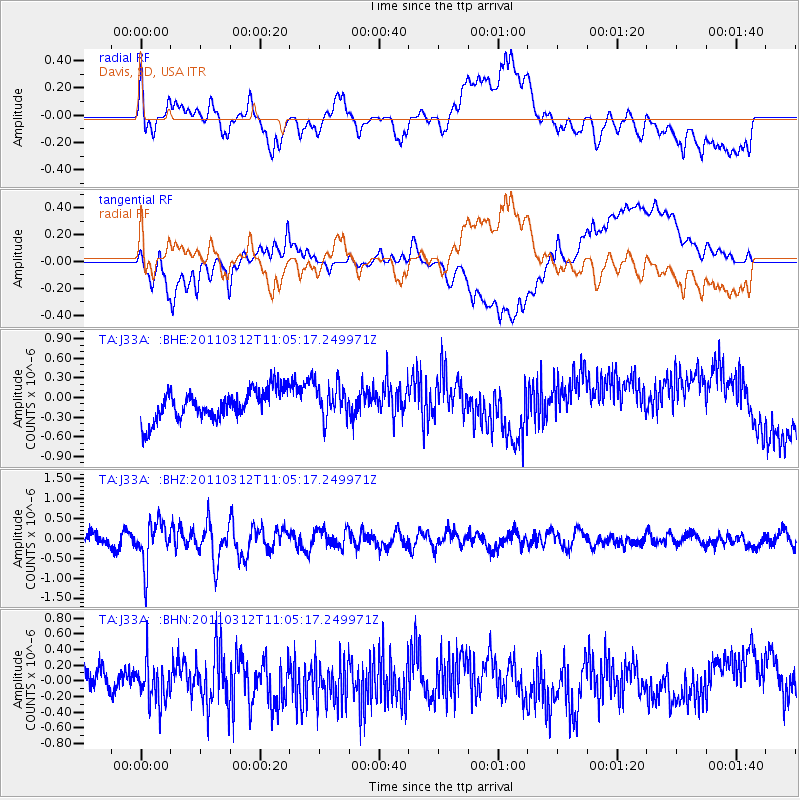
J33A Davis, SD, USA - Earthquake Result Viewer
*The percent match for this event was below the threshold and hence no stack was calculated.
| Earthquake location: |
Near East Coast Of Honshu, Japan |
| Earthquake latitude/longitude: |
39.0/142.3 |
| Earthquake time(UTC): |
2011/03/12 (071) 10:53:30 GMT |
| Earthquake Depth: |
27 km |
| Earthquake Magnitude: |
6.0 MB, 5.4 MS, 5.7 MW, 5.7 MW |
| Earthquake Catalog/Contributor: |
WHDF/NEIC |
|
| Network: |
TA USArray Transportable Network (new EarthScope stations) |
| Station: |
J33A Davis, SD, USA |
| Lat/Lon: |
43.32 N/96.97 W |
| Elevation: |
400 m |
|
| Distance: |
82.1 deg |
| Az: |
39.294 deg |
| Baz: |
317.495 deg |
| Ray Param: |
$rayparam |
*The percent match for this event was below the threshold and hence was not used in the summary stack. |
|
| Radial Match: |
61.880466 % |
| Radial Bump: |
400 |
| Transverse Match: |
62.4295 % |
| Transverse Bump: |
400 |
| SOD ConfigId: |
356183 |
| Insert Time: |
2011-08-19 20:01:04.464 +0000 |
| GWidth: |
2.5 |
| Max Bumps: |
400 |
| Tol: |
0.001 |
|
Signal To Noise
| Channel | StoN | STA | LTA |
| TA:J33A: :BHZ:20110312T11:05:17.249971Z | 3.1323898 | 5.3745623E-7 | 1.7158025E-7 |
| TA:J33A: :BHN:20110312T11:05:17.249971Z | 1.6131358 | 2.4575982E-7 | 1.5234912E-7 |
| TA:J33A: :BHE:20110312T11:05:17.249971Z | 1.1652749 | 2.611705E-7 | 2.241278E-7 |
| Arrivals |
| Ps | |
| PpPs | |
| PsPs/PpSs | |


