You are here: Home > Network List > TA - USArray Transportable Network (new EarthScope stations) Stations List
> Station M36A Felix, Anita, IA, USA > Earthquake Result Viewer
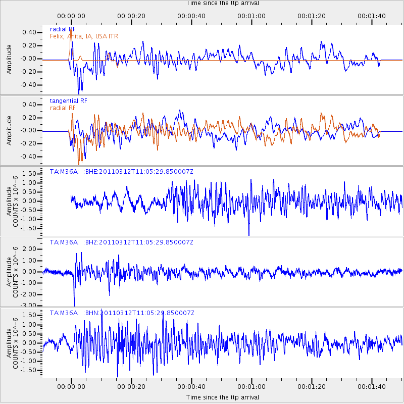
M36A Felix, Anita, IA, USA - Earthquake Result Viewer
*The percent match for this event was below the threshold and hence no stack was calculated.
| Earthquake location: |
Near East Coast Of Honshu, Japan |
| Earthquake latitude/longitude: |
39.0/142.3 |
| Earthquake time(UTC): |
2011/03/12 (071) 10:53:30 GMT |
| Earthquake Depth: |
27 km |
| Earthquake Magnitude: |
6.0 MB, 5.4 MS, 5.7 MW, 5.7 MW |
| Earthquake Catalog/Contributor: |
WHDF/NEIC |
|
| Network: |
TA USArray Transportable Network (new EarthScope stations) |
| Station: |
M36A Felix, Anita, IA, USA |
| Lat/Lon: |
41.45 N/94.80 W |
| Elevation: |
430 m |
|
| Distance: |
84.5 deg |
| Az: |
39.339 deg |
| Baz: |
318.954 deg |
| Ray Param: |
$rayparam |
*The percent match for this event was below the threshold and hence was not used in the summary stack. |
|
| Radial Match: |
68.644394 % |
| Radial Bump: |
400 |
| Transverse Match: |
59.93781 % |
| Transverse Bump: |
400 |
| SOD ConfigId: |
356183 |
| Insert Time: |
2011-08-19 20:18:59.786 +0000 |
| GWidth: |
2.5 |
| Max Bumps: |
400 |
| Tol: |
0.001 |
|
Signal To Noise
| Channel | StoN | STA | LTA |
| TA:M36A: :BHZ:20110312T11:05:29.850007Z | 5.7122545 | 9.1375637E-7 | 1.5996422E-7 |
| TA:M36A: :BHN:20110312T11:05:29.850007Z | 2.9722686 | 6.0538133E-7 | 2.0367652E-7 |
| TA:M36A: :BHE:20110312T11:05:29.850007Z | 1.6132182 | 4.387815E-7 | 2.7199144E-7 |
| Arrivals |
| Ps | |
| PpPs | |
| PsPs/PpSs | |


