You are here: Home > Network List > CN - Canadian National Seismograph Network Stations List
> Station INK INUVIK, NT, CANADA.ANADA > Earthquake Result Viewer
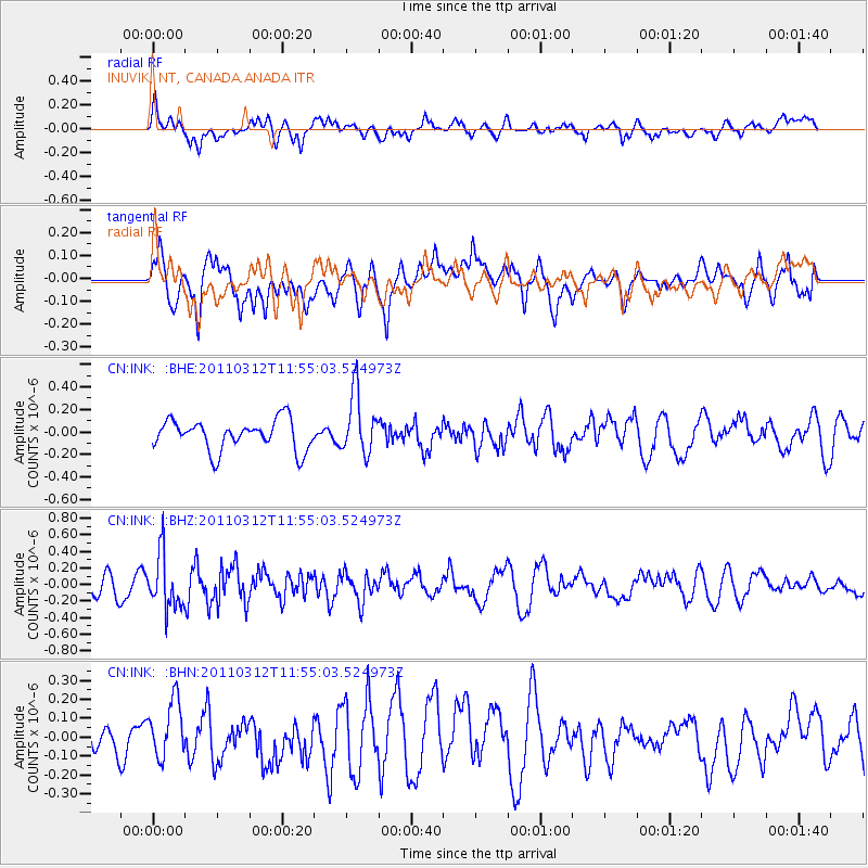
INK INUVIK, NT, CANADA.ANADA - Earthquake Result Viewer
*The percent match for this event was below the threshold and hence no stack was calculated.
| Earthquake location: |
Near East Coast Of Honshu, Japan |
| Earthquake latitude/longitude: |
35.7/141.7 |
| Earthquake time(UTC): |
2011/03/12 (071) 11:45:59 GMT |
| Earthquake Depth: |
10 km |
| Earthquake Magnitude: |
5.6 MB |
| Earthquake Catalog/Contributor: |
WHDF/NEIC |
|
| Network: |
CN Canadian National Seismograph Network |
| Station: |
INK INUVIK, NT, CANADA.ANADA |
| Lat/Lon: |
68.31 N/133.52 W |
| Elevation: |
40 m |
|
| Distance: |
55.4 deg |
| Az: |
26.718 deg |
| Baz: |
280.336 deg |
| Ray Param: |
$rayparam |
*The percent match for this event was below the threshold and hence was not used in the summary stack. |
|
| Radial Match: |
44.019093 % |
| Radial Bump: |
400 |
| Transverse Match: |
54.718266 % |
| Transverse Bump: |
400 |
| SOD ConfigId: |
356183 |
| Insert Time: |
2011-08-19 21:13:35.123 +0000 |
| GWidth: |
2.5 |
| Max Bumps: |
400 |
| Tol: |
0.001 |
|
Signal To Noise
| Channel | StoN | STA | LTA |
| CN:INK: :BHZ:20110312T11:55:03.524973Z | 2.8672705 | 3.311132E-7 | 1.1548028E-7 |
| CN:INK: :BHN:20110312T11:55:03.524973Z | 1.2964917 | 1.5790553E-7 | 1.2179447E-7 |
| CN:INK: :BHE:20110312T11:55:03.524973Z | 2.003789 | 2.697447E-7 | 1.3461732E-7 |
| Arrivals |
| Ps | |
| PpPs | |
| PsPs/PpSs | |


