You are here: Home > Network List > MN - MEDNET Project Stations List
> Station TIP Timpagrande, Italy > Earthquake Result Viewer
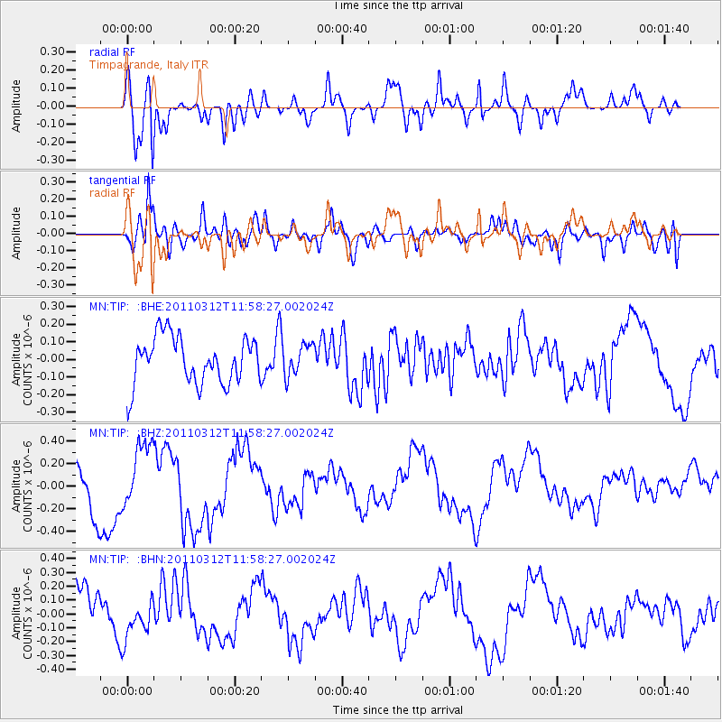
TIP Timpagrande, Italy - Earthquake Result Viewer
*The percent match for this event was below the threshold and hence no stack was calculated.
| Earthquake location: |
Near East Coast Of Honshu, Japan |
| Earthquake latitude/longitude: |
35.7/141.7 |
| Earthquake time(UTC): |
2011/03/12 (071) 11:45:59 GMT |
| Earthquake Depth: |
10 km |
| Earthquake Magnitude: |
5.6 MB |
| Earthquake Catalog/Contributor: |
WHDF/NEIC |
|
| Network: |
MN MEDNET Project |
| Station: |
TIP Timpagrande, Italy |
| Lat/Lon: |
39.18 N/16.76 E |
| Elevation: |
789 m |
|
| Distance: |
89.8 deg |
| Az: |
320.41 deg |
| Baz: |
41.837 deg |
| Ray Param: |
$rayparam |
*The percent match for this event was below the threshold and hence was not used in the summary stack. |
|
| Radial Match: |
65.80497 % |
| Radial Bump: |
400 |
| Transverse Match: |
72.782455 % |
| Transverse Bump: |
400 |
| SOD ConfigId: |
356183 |
| Insert Time: |
2011-08-19 21:25:08.586 +0000 |
| GWidth: |
2.5 |
| Max Bumps: |
400 |
| Tol: |
0.001 |
|
Signal To Noise
| Channel | StoN | STA | LTA |
| MN:TIP: :BHZ:20110312T11:58:27.002024Z | 1.5572112 | 2.9511804E-7 | 1.8951705E-7 |
| MN:TIP: :BHN:20110312T11:58:27.002024Z | 0.839003 | 1.3101207E-7 | 1.5615208E-7 |
| MN:TIP: :BHE:20110312T11:58:27.002024Z | 0.65681356 | 8.744888E-8 | 1.331411E-7 |
| Arrivals |
| Ps | |
| PpPs | |
| PsPs/PpSs | |


