You are here: Home > Network List > US - United States National Seismic Network Stations List
> Station HAWA Hanford, Washington, USA > Earthquake Result Viewer
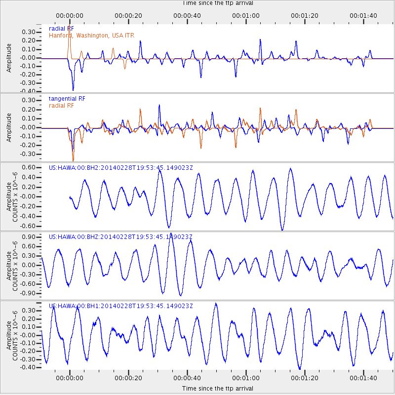
HAWA Hanford, Washington, USA - Earthquake Result Viewer
*The percent match for this event was below the threshold and hence no stack was calculated.
| Earthquake location: |
Kermadec Islands Region |
| Earthquake latitude/longitude: |
-28.5/-176.4 |
| Earthquake time(UTC): |
2014/02/28 (059) 19:41:17 GMT |
| Earthquake Depth: |
29 km |
| Earthquake Magnitude: |
5.0 MW |
| Earthquake Catalog/Contributor: |
ISC/ISC |
|
| Network: |
US United States National Seismic Network |
| Station: |
HAWA Hanford, Washington, USA |
| Lat/Lon: |
46.39 N/119.53 W |
| Elevation: |
364 m |
|
| Distance: |
90.6 deg |
| Az: |
35.412 deg |
| Baz: |
227.436 deg |
| Ray Param: |
$rayparam |
*The percent match for this event was below the threshold and hence was not used in the summary stack. |
|
| Radial Match: |
58.620174 % |
| Radial Bump: |
400 |
| Transverse Match: |
76.347 % |
| Transverse Bump: |
400 |
| SOD ConfigId: |
3390531 |
| Insert Time: |
2019-04-10 11:10:11.526 +0000 |
| GWidth: |
2.5 |
| Max Bumps: |
400 |
| Tol: |
0.001 |
|
Signal To Noise
| Channel | StoN | STA | LTA |
| US:HAWA:00:BHZ:20140228T19:53:45.149023Z | 1.5310982 | 4.2770657E-7 | 2.7934627E-7 |
| US:HAWA:00:BH1:20140228T19:53:45.149023Z | 0.9496273 | 2.1879012E-7 | 2.3039577E-7 |
| US:HAWA:00:BH2:20140228T19:53:45.149023Z | 2.1457312 | 4.0642072E-7 | 1.8940895E-7 |
| Arrivals |
| Ps | |
| PpPs | |
| PsPs/PpSs | |


