You are here: Home > Network List > TA - USArray Transportable Network (new EarthScope stations) Stations List
> Station M36A Felix, Anita, IA, USA > Earthquake Result Viewer
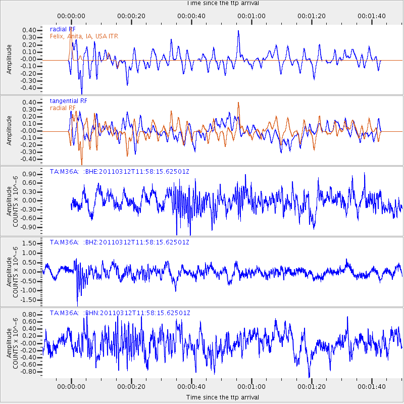
M36A Felix, Anita, IA, USA - Earthquake Result Viewer
*The percent match for this event was below the threshold and hence no stack was calculated.
| Earthquake location: |
Near East Coast Of Honshu, Japan |
| Earthquake latitude/longitude: |
35.7/141.7 |
| Earthquake time(UTC): |
2011/03/12 (071) 11:45:59 GMT |
| Earthquake Depth: |
10 km |
| Earthquake Magnitude: |
5.6 MB |
| Earthquake Catalog/Contributor: |
WHDF/NEIC |
|
| Network: |
TA USArray Transportable Network (new EarthScope stations) |
| Station: |
M36A Felix, Anita, IA, USA |
| Lat/Lon: |
41.45 N/94.80 W |
| Elevation: |
430 m |
|
| Distance: |
87.4 deg |
| Az: |
38.856 deg |
| Baz: |
317.238 deg |
| Ray Param: |
$rayparam |
*The percent match for this event was below the threshold and hence was not used in the summary stack. |
|
| Radial Match: |
58.505905 % |
| Radial Bump: |
400 |
| Transverse Match: |
49.970974 % |
| Transverse Bump: |
400 |
| SOD ConfigId: |
356183 |
| Insert Time: |
2011-08-19 21:51:51.919 +0000 |
| GWidth: |
2.5 |
| Max Bumps: |
400 |
| Tol: |
0.001 |
|
Signal To Noise
| Channel | StoN | STA | LTA |
| TA:M36A: :BHZ:20110312T11:58:15.62501Z | 2.5499816 | 5.4174177E-7 | 2.124493E-7 |
| TA:M36A: :BHN:20110312T11:58:15.62501Z | 1.4775035 | 2.7525533E-7 | 1.8629758E-7 |
| TA:M36A: :BHE:20110312T11:58:15.62501Z | 1.055232 | 2.6634777E-7 | 2.524068E-7 |
| Arrivals |
| Ps | |
| PpPs | |
| PsPs/PpSs | |


