You are here: Home > Network List > TA - USArray Transportable Network (new EarthScope stations) Stations List
> Station L37A Phoenix Point, Boone, IA, USA > Earthquake Result Viewer
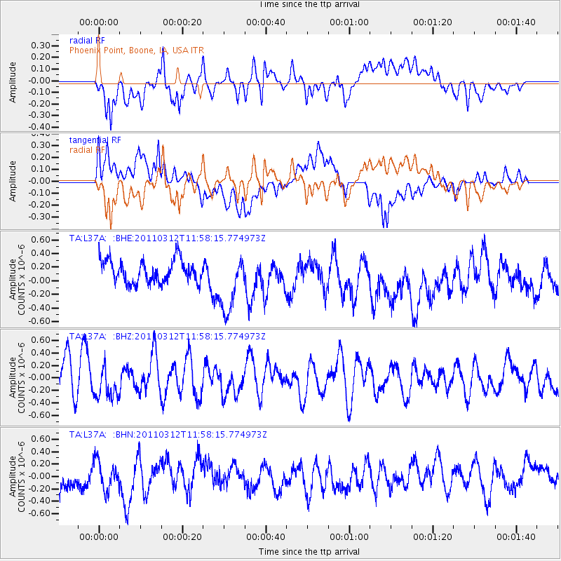
L37A Phoenix Point, Boone, IA, USA - Earthquake Result Viewer
*The percent match for this event was below the threshold and hence no stack was calculated.
| Earthquake location: |
Near East Coast Of Honshu, Japan |
| Earthquake latitude/longitude: |
35.7/141.7 |
| Earthquake time(UTC): |
2011/03/12 (071) 11:45:59 GMT |
| Earthquake Depth: |
10 km |
| Earthquake Magnitude: |
5.6 MB |
| Earthquake Catalog/Contributor: |
WHDF/NEIC |
|
| Network: |
TA USArray Transportable Network (new EarthScope stations) |
| Station: |
L37A Phoenix Point, Boone, IA, USA |
| Lat/Lon: |
42.12 N/93.75 W |
| Elevation: |
312 m |
|
| Distance: |
87.4 deg |
| Az: |
37.824 deg |
| Baz: |
317.887 deg |
| Ray Param: |
$rayparam |
*The percent match for this event was below the threshold and hence was not used in the summary stack. |
|
| Radial Match: |
63.863815 % |
| Radial Bump: |
400 |
| Transverse Match: |
55.63843 % |
| Transverse Bump: |
400 |
| SOD ConfigId: |
356183 |
| Insert Time: |
2011-08-19 21:51:58.676 +0000 |
| GWidth: |
2.5 |
| Max Bumps: |
400 |
| Tol: |
0.001 |
|
Signal To Noise
| Channel | StoN | STA | LTA |
| TA:L37A: :BHZ:20110312T11:58:15.774973Z | 0.866732 | 2.449294E-7 | 2.8258955E-7 |
| TA:L37A: :BHN:20110312T11:58:15.774973Z | 0.8532131 | 2.3474568E-7 | 2.7513138E-7 |
| TA:L37A: :BHE:20110312T11:58:15.774973Z | 2.6704888 | 4.4198904E-7 | 1.6550867E-7 |
| Arrivals |
| Ps | |
| PpPs | |
| PsPs/PpSs | |


