You are here: Home > Network List > US - United States National Seismic Network Stations List
> Station EGMT Eagleton, Montana, USA > Earthquake Result Viewer
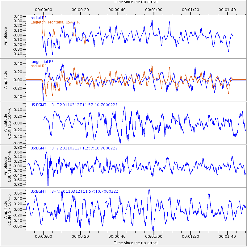
EGMT Eagleton, Montana, USA - Earthquake Result Viewer
*The percent match for this event was below the threshold and hence no stack was calculated.
| Earthquake location: |
Near East Coast Of Honshu, Japan |
| Earthquake latitude/longitude: |
35.7/141.7 |
| Earthquake time(UTC): |
2011/03/12 (071) 11:45:59 GMT |
| Earthquake Depth: |
10 km |
| Earthquake Magnitude: |
5.6 MB |
| Earthquake Catalog/Contributor: |
WHDF/NEIC |
|
| Network: |
US United States National Seismic Network |
| Station: |
EGMT Eagleton, Montana, USA |
| Lat/Lon: |
48.02 N/109.75 W |
| Elevation: |
1055 m |
|
| Distance: |
75.1 deg |
| Az: |
41.187 deg |
| Baz: |
307.059 deg |
| Ray Param: |
$rayparam |
*The percent match for this event was below the threshold and hence was not used in the summary stack. |
|
| Radial Match: |
56.746185 % |
| Radial Bump: |
400 |
| Transverse Match: |
56.117393 % |
| Transverse Bump: |
400 |
| SOD ConfigId: |
356183 |
| Insert Time: |
2011-08-19 21:59:38.330 +0000 |
| GWidth: |
2.5 |
| Max Bumps: |
400 |
| Tol: |
0.001 |
|
Signal To Noise
| Channel | StoN | STA | LTA |
| US:EGMT: :BHZ:20110312T11:57:10.700022Z | 2.7407784 | 3.7881793E-7 | 1.3821546E-7 |
| US:EGMT: :BHN:20110312T11:57:10.700022Z | 0.8365008 | 2.2245307E-7 | 2.6593287E-7 |
| US:EGMT: :BHE:20110312T11:57:10.700022Z | 0.9892621 | 1.689178E-7 | 1.707513E-7 |
| Arrivals |
| Ps | |
| PpPs | |
| PsPs/PpSs | |


