
RDM AZ.RDM - Earthquake Result Viewer

| ||||||||||||||||||
| ||||||||||||||||||
| ||||||||||||||||||
|
Signal To Noise
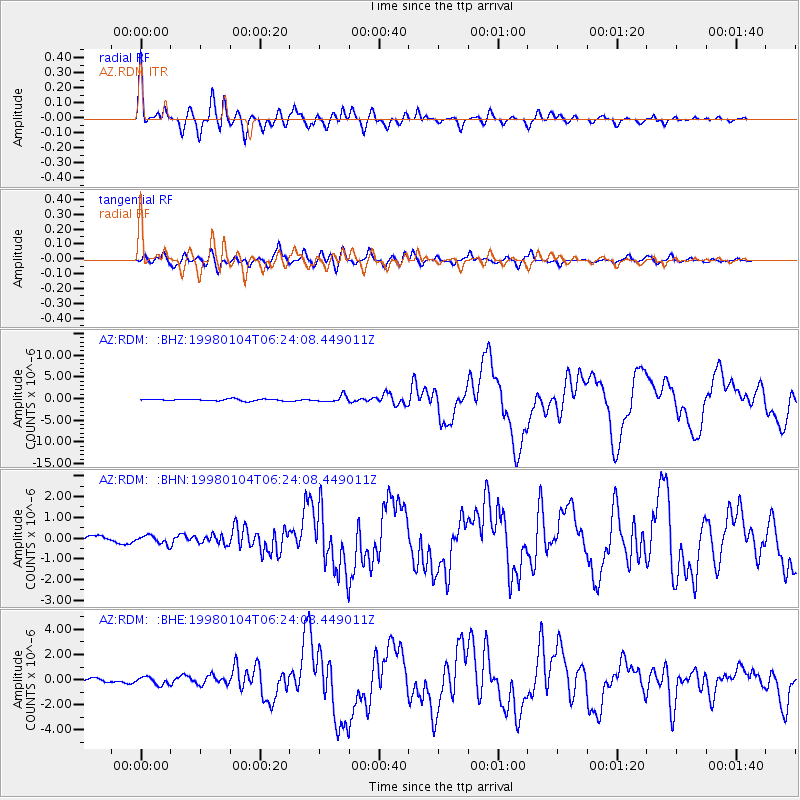
| Channel | StoN | STA | LTA |
| AZ:RDM: :BHN:19980104T06:24:08.449011Z | 0.80887353 | 1.9951779E-7 | 2.4666127E-7 |
| AZ:RDM: :BHE:19980104T06:24:08.449011Z | 1.4342868 | 2.982233E-7 | 2.0792446E-7 |
| AZ:RDM: :BHZ:19980104T06:24:08.449011Z | 3.696201 | 7.357017E-7 | 1.9904266E-7 |
| Arrivals | |
| Ps | 3.6 SECOND |
| PpPs | 14 SECOND |
| PsPs/PpSs | 18 SECOND |

