You are here: Home > Network List > CI - Caltech Regional Seismic Network Stations List
> Station SMM Simmler, CA, USA > Earthquake Result Viewer
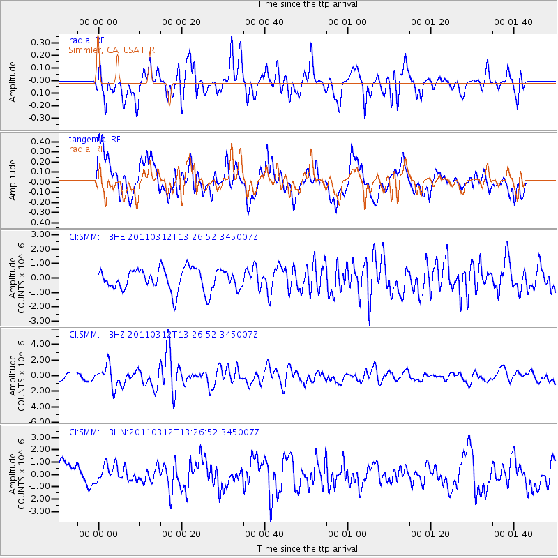
SMM Simmler, CA, USA - Earthquake Result Viewer
*The percent match for this event was below the threshold and hence no stack was calculated.
| Earthquake location: |
Near East Coast Of Honshu, Japan |
| Earthquake latitude/longitude: |
37.2/141.2 |
| Earthquake time(UTC): |
2011/03/12 (071) 13:15:41 GMT |
| Earthquake Depth: |
38 km |
| Earthquake Magnitude: |
6.1 MB, 5.9 MS, 6.2 MW, 6.1 MW |
| Earthquake Catalog/Contributor: |
WHDF/NEIC |
|
| Network: |
CI Caltech Regional Seismic Network |
| Station: |
SMM Simmler, CA, USA |
| Lat/Lon: |
35.31 N/120.00 W |
| Elevation: |
599 m |
|
| Distance: |
75.7 deg |
| Az: |
56.493 deg |
| Baz: |
305.553 deg |
| Ray Param: |
$rayparam |
*The percent match for this event was below the threshold and hence was not used in the summary stack. |
|
| Radial Match: |
67.783554 % |
| Radial Bump: |
400 |
| Transverse Match: |
74.507545 % |
| Transverse Bump: |
400 |
| SOD ConfigId: |
356183 |
| Insert Time: |
2011-08-19 23:10:02.116 +0000 |
| GWidth: |
2.5 |
| Max Bumps: |
400 |
| Tol: |
0.001 |
|
Signal To Noise
| Channel | StoN | STA | LTA |
| CI:SMM: :BHZ:20110312T13:26:52.345007Z | 2.4779673 | 1.3803663E-6 | 5.570559E-7 |
| CI:SMM: :BHN:20110312T13:26:52.345007Z | 0.94932175 | 7.4390346E-7 | 7.8361575E-7 |
| CI:SMM: :BHE:20110312T13:26:52.345007Z | 0.7819278 | 5.6637E-7 | 7.243251E-7 |
| Arrivals |
| Ps | |
| PpPs | |
| PsPs/PpSs | |


