You are here: Home > Network List > TA - USArray Transportable Network (new EarthScope stations) Stations List
> Station Q28A Sharon Springs, KS, USA > Earthquake Result Viewer
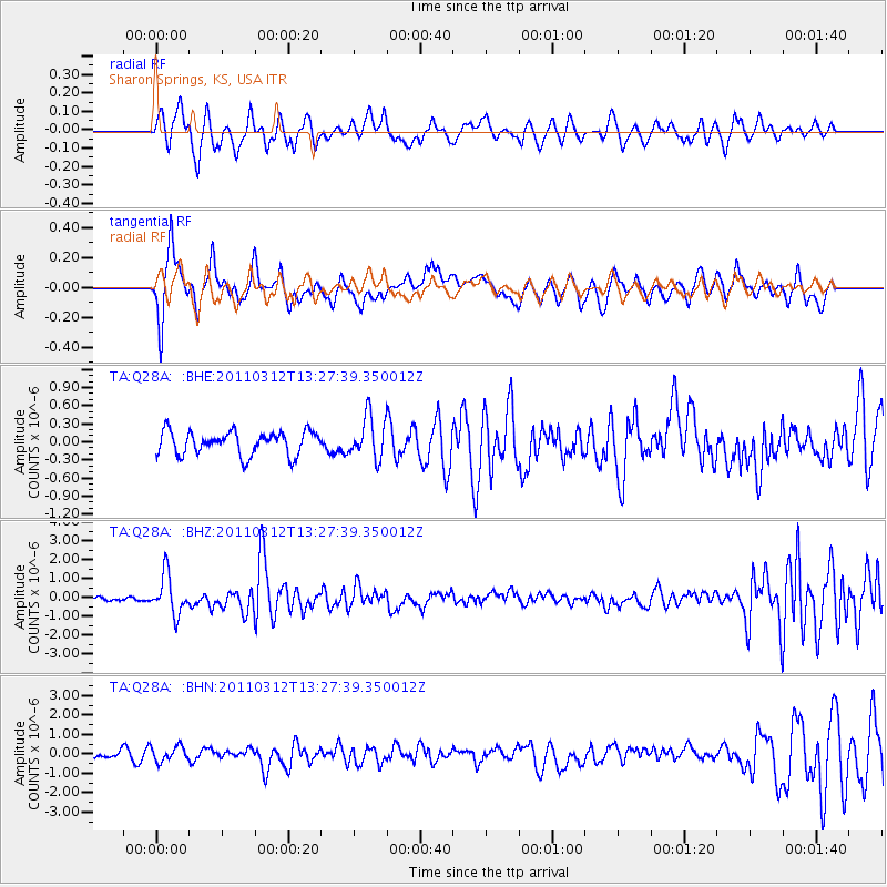
Q28A Sharon Springs, KS, USA - Earthquake Result Viewer
*The percent match for this event was below the threshold and hence no stack was calculated.
| Earthquake location: |
Near East Coast Of Honshu, Japan |
| Earthquake latitude/longitude: |
37.2/141.2 |
| Earthquake time(UTC): |
2011/03/12 (071) 13:15:41 GMT |
| Earthquake Depth: |
38 km |
| Earthquake Magnitude: |
6.1 MB, 5.9 MS, 6.2 MW, 6.1 MW |
| Earthquake Catalog/Contributor: |
WHDF/NEIC |
|
| Network: |
TA USArray Transportable Network (new EarthScope stations) |
| Station: |
Q28A Sharon Springs, KS, USA |
| Lat/Lon: |
39.06 N/101.83 W |
| Elevation: |
1133 m |
|
| Distance: |
84.5 deg |
| Az: |
44.174 deg |
| Baz: |
314.419 deg |
| Ray Param: |
$rayparam |
*The percent match for this event was below the threshold and hence was not used in the summary stack. |
|
| Radial Match: |
63.255768 % |
| Radial Bump: |
400 |
| Transverse Match: |
72.643364 % |
| Transverse Bump: |
400 |
| SOD ConfigId: |
356183 |
| Insert Time: |
2011-08-19 23:37:24.766 +0000 |
| GWidth: |
2.5 |
| Max Bumps: |
400 |
| Tol: |
0.001 |
|
Signal To Noise
| Channel | StoN | STA | LTA |
| TA:Q28A: :BHZ:20110312T13:27:39.350012Z | 5.855393 | 1.035505E-6 | 1.7684636E-7 |
| TA:Q28A: :BHN:20110312T13:27:39.350012Z | 1.8668655 | 3.8294243E-7 | 2.0512589E-7 |
| TA:Q28A: :BHE:20110312T13:27:39.350012Z | 1.8162237 | 3.537132E-7 | 1.94752E-7 |
| Arrivals |
| Ps | |
| PpPs | |
| PsPs/PpSs | |


