You are here: Home > Network List > TA - USArray Transportable Network (new EarthScope stations) Stations List
> Station P29A Atwood, KS, USA > Earthquake Result Viewer
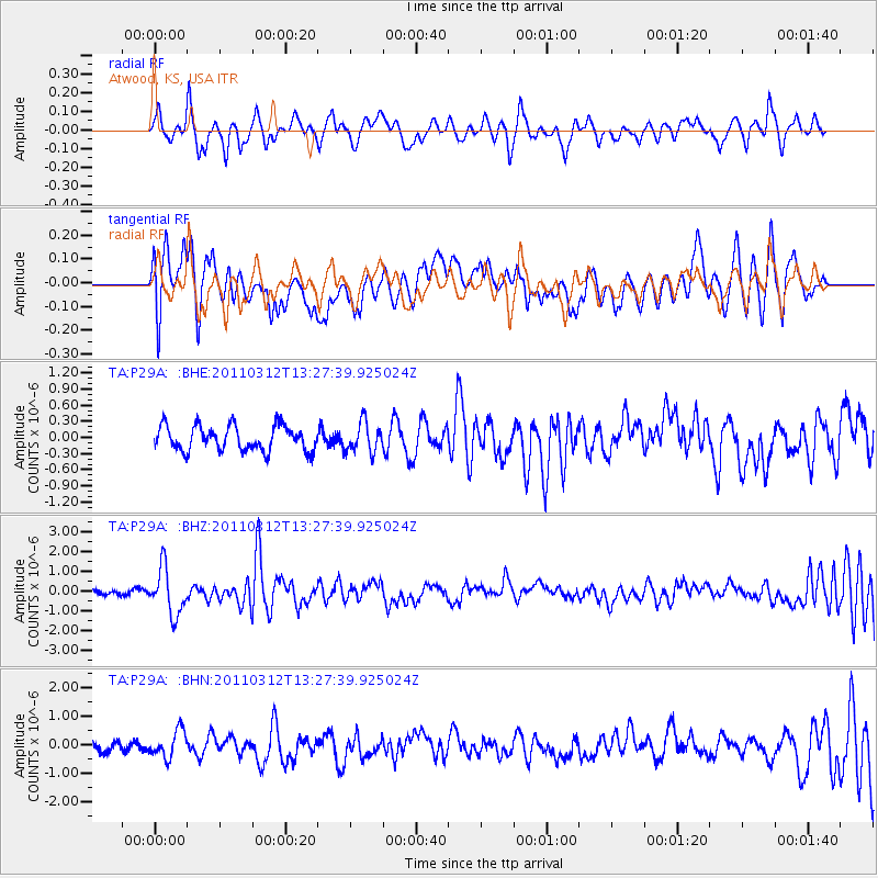
P29A Atwood, KS, USA - Earthquake Result Viewer
*The percent match for this event was below the threshold and hence no stack was calculated.
| Earthquake location: |
Near East Coast Of Honshu, Japan |
| Earthquake latitude/longitude: |
37.2/141.2 |
| Earthquake time(UTC): |
2011/03/12 (071) 13:15:41 GMT |
| Earthquake Depth: |
38 km |
| Earthquake Magnitude: |
6.1 MB, 5.9 MS, 6.2 MW, 6.1 MW |
| Earthquake Catalog/Contributor: |
WHDF/NEIC |
|
| Network: |
TA USArray Transportable Network (new EarthScope stations) |
| Station: |
P29A Atwood, KS, USA |
| Lat/Lon: |
39.60 N/100.93 W |
| Elevation: |
929 m |
|
| Distance: |
84.6 deg |
| Az: |
43.296 deg |
| Baz: |
314.904 deg |
| Ray Param: |
$rayparam |
*The percent match for this event was below the threshold and hence was not used in the summary stack. |
|
| Radial Match: |
62.2062 % |
| Radial Bump: |
400 |
| Transverse Match: |
62.821526 % |
| Transverse Bump: |
400 |
| SOD ConfigId: |
356183 |
| Insert Time: |
2011-08-19 23:38:31.234 +0000 |
| GWidth: |
2.5 |
| Max Bumps: |
400 |
| Tol: |
0.001 |
|
Signal To Noise
| Channel | StoN | STA | LTA |
| TA:P29A: :BHZ:20110312T13:27:39.925024Z | 9.4991865 | 1.1724062E-6 | 1.2342176E-7 |
| TA:P29A: :BHN:20110312T13:27:39.925024Z | 1.9909642 | 4.6702274E-7 | 2.3457115E-7 |
| TA:P29A: :BHE:20110312T13:27:39.925024Z | 1.1734788 | 2.6969016E-7 | 2.2982105E-7 |
| Arrivals |
| Ps | |
| PpPs | |
| PsPs/PpSs | |


