H28A Mission Ridge, SD, USA - Earthquake Result Viewer
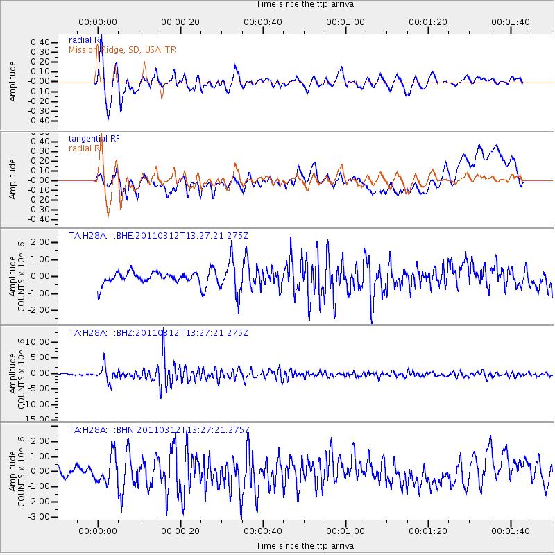
Earthquake location: Near East Coast Of Honshu, Japan
Earthquake latitude/longitude: 37.2/141.2
Earthquake time(UTC): 2011/03/12 (071) 13:15:41 GMT
Earthquake Depth: 38 km
Earthquake Magnitude: 6.1 MB, 5.9 MS, 6.2 MW, 6.1 MW
Earthquake Catalog/Contributor: WHDF/NEIC
Network: TA USArray Transportable Network (new EarthScope stations)
Station: H28A Mission Ridge, SD, USA
Lat/Lon: 44.68 N/101.02 W
Elevation: 642 m
Distance: 81.0 deg
Az: 39.708 deg
Baz: 314.394 deg
Ray Param: 0.047843885
Estimated Moho Depth: 12.0 km
Estimated Crust Vp/Vs: 1.60
Assumed Crust Vp: 6.53 km/s
Estimated Crust Vs: 4.082 km/s
Estimated Crust Poisson's Ratio: 0.18
Radial Match: 87.84038 %
Radial Bump: 400
Transverse Match: 69.09537 %
Transverse Bump: 400
SOD ConfigId: 356183
Insert Time: 2011-08-19 23:47:05.150 +0000
GWidth: 2.5
Max Bumps: 400
Tol: 0.001

Signal To Noise

ChannelStoNSTALTA
TA:H28A: :BHZ:20110312T13:27:21.275Z10.9535452.424231E-62.2131934E-7
TA:H28A: :BHN:20110312T13:27:21.275Z2.95216739.343389E-73.1649253E-7
TA:H28A: :BHE:20110312T13:27:21.275Z3.17001689.867014E-73.112606E-7
Arrivals
Ps1.1 SECOND
PpPs4.6 SECOND
PsPs/PpSs5.8 SECOND