You are here: Home > Network List > TA - USArray Transportable Network (new EarthScope stations) Stations List
> Station TUL1 Leonard, OK, USA > Earthquake Result Viewer
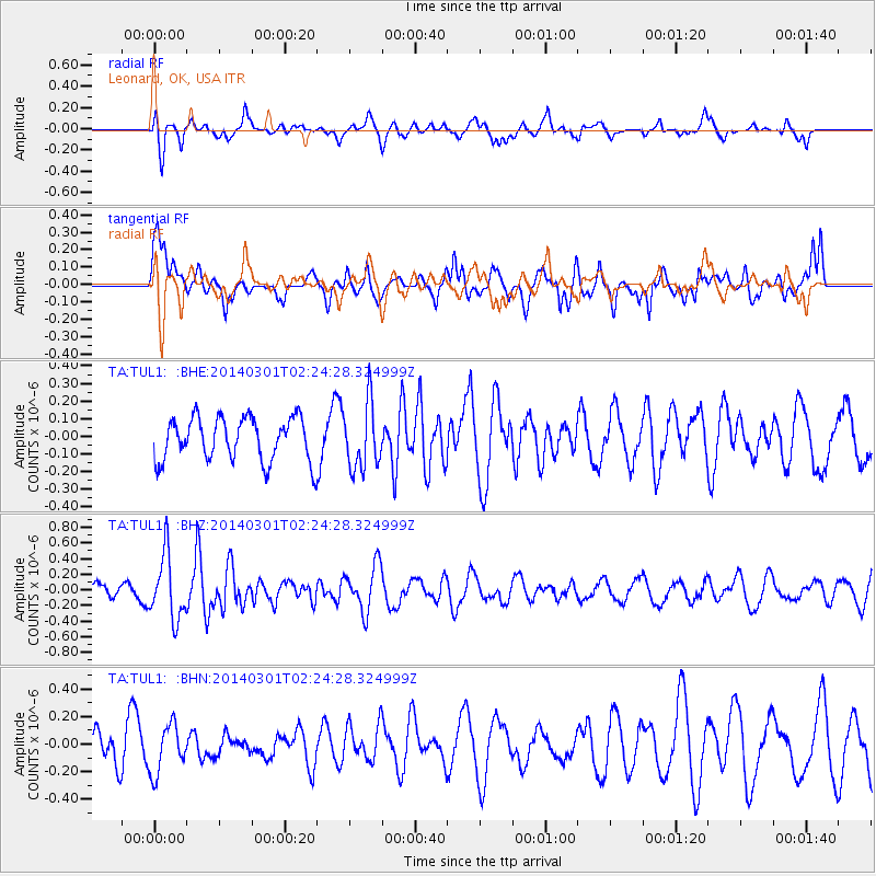
TUL1 Leonard, OK, USA - Earthquake Result Viewer
*The percent match for this event was below the threshold and hence no stack was calculated.
| Earthquake location: |
Northern Mid-Atlantic Ridge |
| Earthquake latitude/longitude: |
32.2/-40.3 |
| Earthquake time(UTC): |
2014/03/01 (060) 02:16:39 GMT |
| Earthquake Depth: |
14 km |
| Earthquake Magnitude: |
5.2 MW |
| Earthquake Catalog/Contributor: |
ISC/ISC |
|
| Network: |
TA USArray Transportable Network (new EarthScope stations) |
| Station: |
TUL1 Leonard, OK, USA |
| Lat/Lon: |
35.91 N/95.79 W |
| Elevation: |
256 m |
|
| Distance: |
45.6 deg |
| Az: |
290.597 deg |
| Baz: |
77.89 deg |
| Ray Param: |
$rayparam |
*The percent match for this event was below the threshold and hence was not used in the summary stack. |
|
| Radial Match: |
51.09891 % |
| Radial Bump: |
400 |
| Transverse Match: |
60.145905 % |
| Transverse Bump: |
400 |
| SOD ConfigId: |
3390531 |
| Insert Time: |
2019-04-10 11:16:12.696 +0000 |
| GWidth: |
2.5 |
| Max Bumps: |
400 |
| Tol: |
0.001 |
|
Signal To Noise
| Channel | StoN | STA | LTA |
| TA:TUL1: :BHZ:20140301T02:24:28.324999Z | 2.436387 | 4.095944E-7 | 1.6811549E-7 |
| TA:TUL1: :BHN:20140301T02:24:28.324999Z | 1.2036978 | 1.7527265E-7 | 1.4561184E-7 |
| TA:TUL1: :BHE:20140301T02:24:28.324999Z | 1.5215005 | 1.8540803E-7 | 1.2185868E-7 |
| Arrivals |
| Ps | |
| PpPs | |
| PsPs/PpSs | |


