You are here: Home > Network List > TA - USArray Transportable Network (new EarthScope stations) Stations List
> Station W57A Gilead, NC, USA > Earthquake Result Viewer
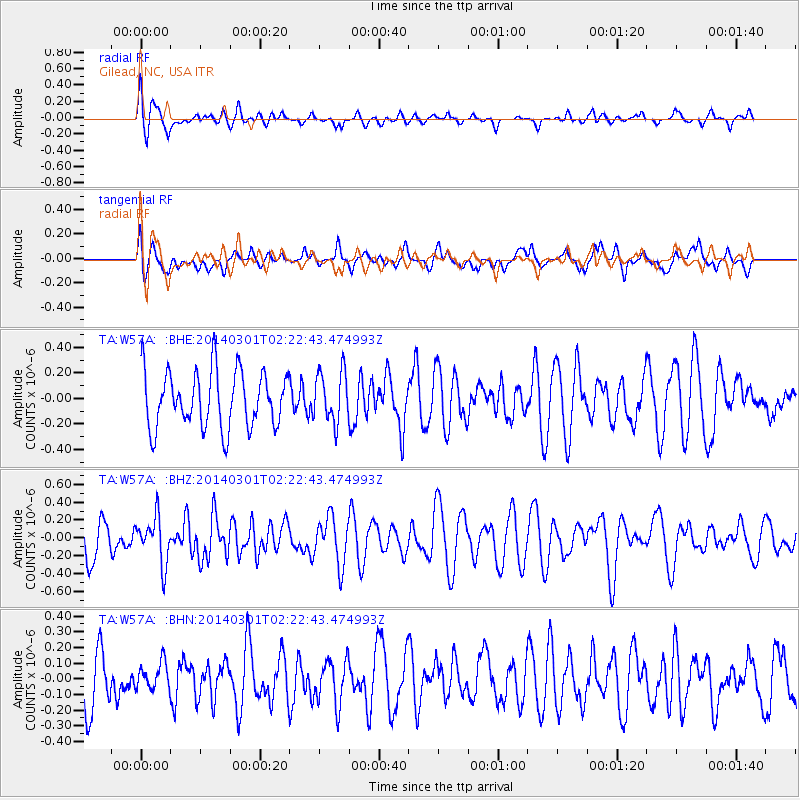
W57A Gilead, NC, USA - Earthquake Result Viewer
*The percent match for this event was below the threshold and hence no stack was calculated.
| Earthquake location: |
Northern Mid-Atlantic Ridge |
| Earthquake latitude/longitude: |
32.2/-40.3 |
| Earthquake time(UTC): |
2014/03/01 (060) 02:16:39 GMT |
| Earthquake Depth: |
14 km |
| Earthquake Magnitude: |
5.2 MW |
| Earthquake Catalog/Contributor: |
ISC/ISC |
|
| Network: |
TA USArray Transportable Network (new EarthScope stations) |
| Station: |
W57A Gilead, NC, USA |
| Lat/Lon: |
35.15 N/79.99 W |
| Elevation: |
85 m |
|
| Distance: |
33.0 deg |
| Az: |
286.175 deg |
| Baz: |
83.628 deg |
| Ray Param: |
$rayparam |
*The percent match for this event was below the threshold and hence was not used in the summary stack. |
|
| Radial Match: |
69.905846 % |
| Radial Bump: |
400 |
| Transverse Match: |
53.66604 % |
| Transverse Bump: |
400 |
| SOD ConfigId: |
3390531 |
| Insert Time: |
2019-04-10 11:16:18.917 +0000 |
| GWidth: |
2.5 |
| Max Bumps: |
400 |
| Tol: |
0.001 |
|
Signal To Noise
| Channel | StoN | STA | LTA |
| TA:W57A: :BHZ:20140301T02:22:43.474993Z | 0.82391113 | 2.584333E-7 | 3.1366645E-7 |
| TA:W57A: :BHN:20140301T02:22:43.474993Z | 0.46196657 | 8.303167E-8 | 1.7973524E-7 |
| TA:W57A: :BHE:20140301T02:22:43.474993Z | 0.9048928 | 1.997801E-7 | 2.2077765E-7 |
| Arrivals |
| Ps | |
| PpPs | |
| PsPs/PpSs | |


