You are here: Home > Network List > TA - USArray Transportable Network (new EarthScope stations) Stations List
> Station 340A Bronson, TX, USA > Earthquake Result Viewer
340A Bronson, TX, USA - Earthquake Result Viewer
*The percent match for this event was below the threshold and hence no stack was calculated.
| Earthquake location: |
Near East Coast Of Honshu, Japan |
| Earthquake latitude/longitude: |
37.2/141.2 |
| Earthquake time(UTC): |
2011/03/12 (071) 13:15:41 GMT |
| Earthquake Depth: |
38 km |
| Earthquake Magnitude: |
6.1 MB, 5.9 MS, 6.2 MW, 6.1 MW |
| Earthquake Catalog/Contributor: |
WHDF/NEIC |
|
| Network: |
TA USArray Transportable Network (new EarthScope stations) |
| Station: |
340A Bronson, TX, USA |
| Lat/Lon: |
31.42 N/93.89 W |
| Elevation: |
57 m |
|
| Distance: |
94.5 deg |
| Az: |
44.66 deg |
| Baz: |
319.001 deg |
| Ray Param: |
$rayparam |
*The percent match for this event was below the threshold and hence was not used in the summary stack. |
|
| Radial Match: |
44.33327 % |
| Radial Bump: |
400 |
| Transverse Match: |
61.062164 % |
| Transverse Bump: |
338 |
| SOD ConfigId: |
356183 |
| Insert Time: |
2011-08-20 00:18:46.576 +0000 |
| GWidth: |
2.5 |
| Max Bumps: |
400 |
| Tol: |
0.001 |
|
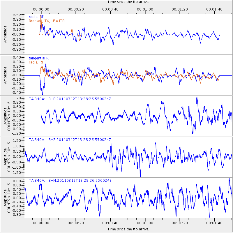
Signal To Noise
| Channel | StoN | STA | LTA |
| TA:340A: :BHZ:20110312T13:28:26.550024Z | 2.4168632 | 4.0046294E-7 | 1.6569533E-7 |
| TA:340A: :BHN:20110312T13:28:26.550024Z | 1.2740873 | 3.3876842E-7 | 2.6589106E-7 |
| TA:340A: :BHE:20110312T13:28:26.550024Z | 1.1457119 | 2.900964E-7 | 2.5320188E-7 |
| Arrivals |
| Ps | |
| PpPs | |
| PsPs/PpSs | |


