You are here: Home > Network List > TA - USArray Transportable Network (new EarthScope stations) Stations List
> Station 239A Gary, TX, USA > Earthquake Result Viewer
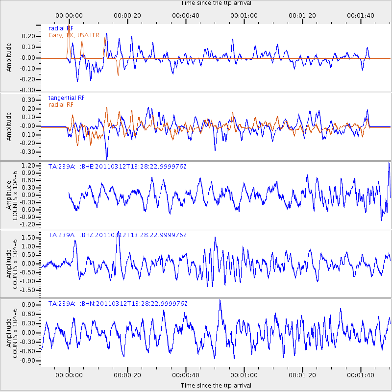
239A Gary, TX, USA - Earthquake Result Viewer
*The percent match for this event was below the threshold and hence no stack was calculated.
| Earthquake location: |
Near East Coast Of Honshu, Japan |
| Earthquake latitude/longitude: |
37.2/141.2 |
| Earthquake time(UTC): |
2011/03/12 (071) 13:15:41 GMT |
| Earthquake Depth: |
38 km |
| Earthquake Magnitude: |
6.1 MB, 5.9 MS, 6.2 MW, 6.1 MW |
| Earthquake Catalog/Contributor: |
WHDF/NEIC |
|
| Network: |
TA USArray Transportable Network (new EarthScope stations) |
| Station: |
239A Gary, TX, USA |
| Lat/Lon: |
32.02 N/94.47 W |
| Elevation: |
100 m |
|
| Distance: |
93.7 deg |
| Az: |
44.639 deg |
| Baz: |
318.698 deg |
| Ray Param: |
$rayparam |
*The percent match for this event was below the threshold and hence was not used in the summary stack. |
|
| Radial Match: |
48.534344 % |
| Radial Bump: |
400 |
| Transverse Match: |
64.876274 % |
| Transverse Bump: |
400 |
| SOD ConfigId: |
356183 |
| Insert Time: |
2011-08-20 00:19:18.799 +0000 |
| GWidth: |
2.5 |
| Max Bumps: |
400 |
| Tol: |
0.001 |
|
Signal To Noise
| Channel | StoN | STA | LTA |
| TA:239A: :BHZ:20110312T13:28:22.999976Z | 3.1273117 | 6.3473544E-7 | 2.029652E-7 |
| TA:239A: :BHN:20110312T13:28:22.999976Z | 1.2483163 | 3.0844026E-7 | 2.4708504E-7 |
| TA:239A: :BHE:20110312T13:28:22.999976Z | 1.5330145 | 3.8657873E-7 | 2.52169E-7 |
| Arrivals |
| Ps | |
| PpPs | |
| PsPs/PpSs | |


