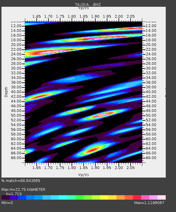
J31A Geddes, SD, USA - Earthquake Result Viewer
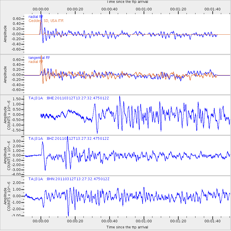
Earthquake location: Near East Coast Of Honshu, Japan
Earthquake latitude/longitude: 37.2/141.2
Earthquake time(UTC): 2011/03/12 (071) 13:15:41 GMT
Earthquake Depth: 38 km
Earthquake Magnitude: 6.1 MB, 5.9 MS, 6.2 MW, 6.1 MW
Earthquake Catalog/Contributor: WHDF/NEIC
Network: TA USArray Transportable Network (new EarthScope stations)
Station: J31A Geddes, SD, USA
Lat/Lon: 43.29 N/98.74 W
Elevation: 491 m
Distance: 83.1 deg
Az: 39.514 deg
Baz: 315.946 deg
Ray Param: 0.046350244
Estimated Moho Depth: 22.75 km
Estimated Crust Vp/Vs: 1.72
Assumed Crust Vp: 6.53 km/s
Estimated Crust Vs: 3.808 km/s
Estimated Crust Poisson's Ratio: 0.24
Radial Match: 88.843895 %
Radial Bump: 400
Transverse Match: 64.589035 %
Transverse Bump: 400
SOD ConfigId: 356183
Insert Time: 2011-08-20 00:45:27.725 +0000
GWidth: 2.5
Max Bumps: 400
Tol: 0.001

Signal To Noise

ChannelStoNSTALTA
TA:J31A: :BHZ:20110312T13:27:32.475012Z9.5459531.4411632E-61.5097113E-7
TA:J31A: :BHN:20110312T13:27:32.475012Z3.9640397.1464257E-71.8028142E-7
TA:J31A: :BHE:20110312T13:27:32.475012Z3.49743997.5420013E-72.1564348E-7
Arrivals
Ps2.6 SECOND
PpPs9.2 SECOND
PsPs/PpSs12 SECOND