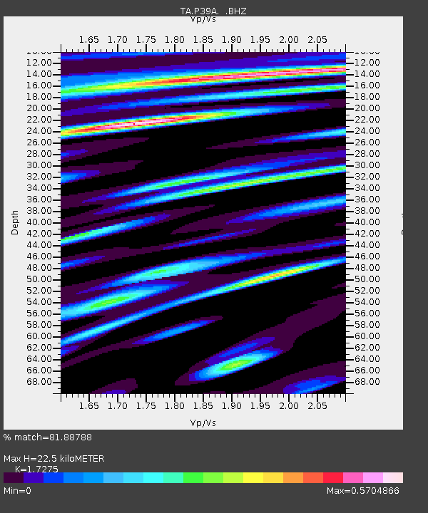
P39A Salisbury, MO, USA - Earthquake Result Viewer
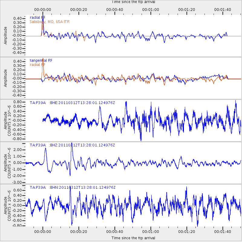
Earthquake location: Near East Coast Of Honshu, Japan
Earthquake latitude/longitude: 37.2/141.2
Earthquake time(UTC): 2011/03/12 (071) 13:15:41 GMT
Earthquake Depth: 38 km
Earthquake Magnitude: 6.1 MB, 5.9 MS, 6.2 MW, 6.1 MW
Earthquake Catalog/Contributor: WHDF/NEIC
Network: TA USArray Transportable Network (new EarthScope stations)
Station: P39A Salisbury, MO, USA
Lat/Lon: 39.49 N/92.75 W
Elevation: 232 m
Distance: 89.0 deg
Az: 38.717 deg
Baz: 319.837 deg
Ray Param: 0.042141084
Estimated Moho Depth: 22.5 km
Estimated Crust Vp/Vs: 1.73
Assumed Crust Vp: 6.498 km/s
Estimated Crust Vs: 3.761 km/s
Estimated Crust Poisson's Ratio: 0.25
Radial Match: 81.88788 %
Radial Bump: 400
Transverse Match: 61.899593 %
Transverse Bump: 400
SOD ConfigId: 356183
Insert Time: 2011-08-20 00:58:25.033 +0000
GWidth: 2.5
Max Bumps: 400
Tol: 0.001

Signal To Noise

ChannelStoNSTALTA
TA:P39A: :BHZ:20110312T13:28:01.124976Z6.70811131.1443411E-61.7059065E-7
TA:P39A: :BHN:20110312T13:28:01.124976Z1.42997812.8220643E-71.9735018E-7
TA:P39A: :BHE:20110312T13:28:01.124976Z2.27229382.8713094E-71.2636171E-7
Arrivals
Ps2.6 SECOND
PpPs9.2 SECOND
PsPs/PpSs12 SECOND