You are here: Home > Network List > TA - USArray Transportable Network (new EarthScope stations) Stations List
> Station R38A Fenwick Farm, Montrose, MO, USA > Earthquake Result Viewer
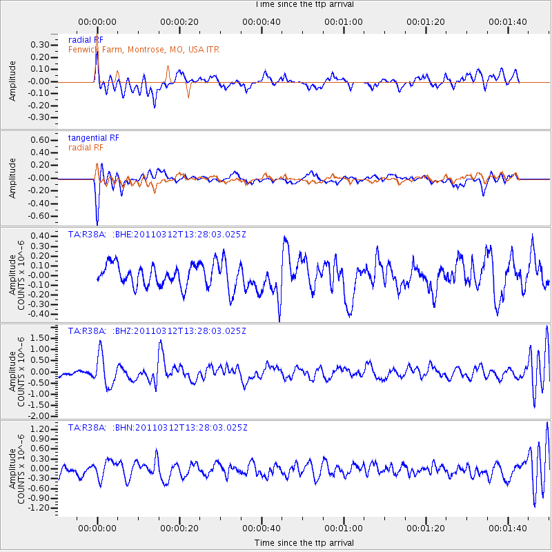
R38A Fenwick Farm, Montrose, MO, USA - Earthquake Result Viewer
*The percent match for this event was below the threshold and hence no stack was calculated.
| Earthquake location: |
Near East Coast Of Honshu, Japan |
| Earthquake latitude/longitude: |
37.2/141.2 |
| Earthquake time(UTC): |
2011/03/12 (071) 13:15:41 GMT |
| Earthquake Depth: |
38 km |
| Earthquake Magnitude: |
6.1 MB, 5.9 MS, 6.2 MW, 6.1 MW |
| Earthquake Catalog/Contributor: |
WHDF/NEIC |
|
| Network: |
TA USArray Transportable Network (new EarthScope stations) |
| Station: |
R38A Fenwick Farm, Montrose, MO, USA |
| Lat/Lon: |
38.19 N/93.91 W |
| Elevation: |
237 m |
|
| Distance: |
89.4 deg |
| Az: |
40.244 deg |
| Baz: |
319.14 deg |
| Ray Param: |
$rayparam |
*The percent match for this event was below the threshold and hence was not used in the summary stack. |
|
| Radial Match: |
56.065796 % |
| Radial Bump: |
400 |
| Transverse Match: |
69.54061 % |
| Transverse Bump: |
400 |
| SOD ConfigId: |
356183 |
| Insert Time: |
2011-08-20 00:59:33.729 +0000 |
| GWidth: |
2.5 |
| Max Bumps: |
400 |
| Tol: |
0.001 |
|
Signal To Noise
| Channel | StoN | STA | LTA |
| TA:R38A: :BHZ:20110312T13:28:03.025Z | 5.1149263 | 6.9368105E-7 | 1.3561896E-7 |
| TA:R38A: :BHN:20110312T13:28:03.025Z | 1.9692569 | 2.6372902E-7 | 1.3392312E-7 |
| TA:R38A: :BHE:20110312T13:28:03.025Z | 1.6260053 | 1.6643105E-7 | 1.02355784E-7 |
| Arrivals |
| Ps | |
| PpPs | |
| PsPs/PpSs | |


