You are here: Home > Network List > US - United States National Seismic Network Stations List
> Station WMOK Wichita Mountains, Oklahoma, USA > Earthquake Result Viewer
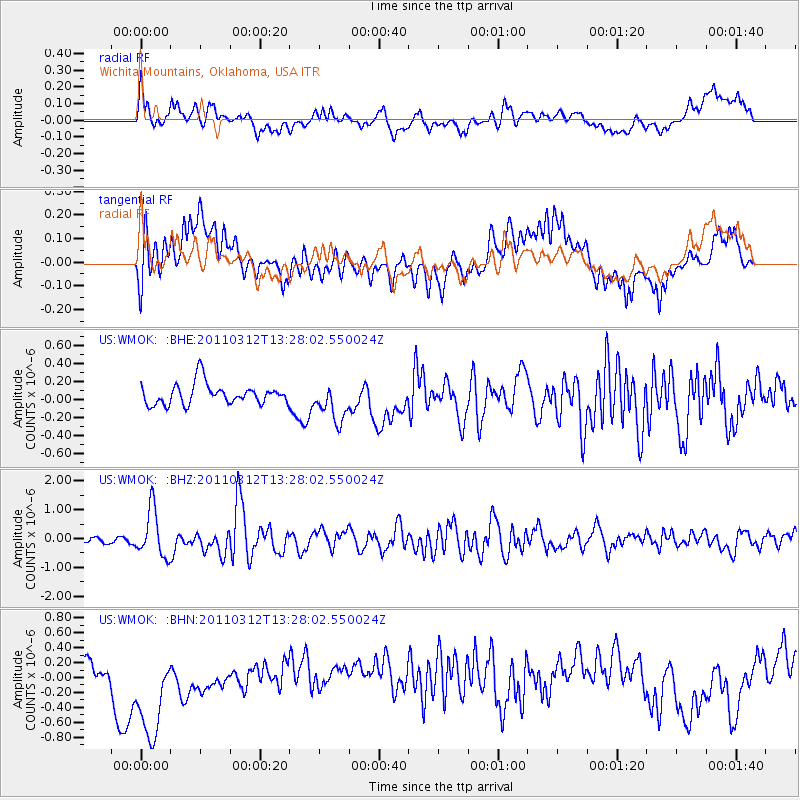
WMOK Wichita Mountains, Oklahoma, USA - Earthquake Result Viewer
*The percent match for this event was below the threshold and hence no stack was calculated.
| Earthquake location: |
Near East Coast Of Honshu, Japan |
| Earthquake latitude/longitude: |
37.2/141.2 |
| Earthquake time(UTC): |
2011/03/12 (071) 13:15:41 GMT |
| Earthquake Depth: |
38 km |
| Earthquake Magnitude: |
6.1 MB, 5.9 MS, 6.2 MW, 6.1 MW |
| Earthquake Catalog/Contributor: |
WHDF/NEIC |
|
| Network: |
US United States National Seismic Network |
| Station: |
WMOK Wichita Mountains, Oklahoma, USA |
| Lat/Lon: |
34.74 N/98.78 W |
| Elevation: |
486 m |
|
| Distance: |
89.3 deg |
| Az: |
45.467 deg |
| Baz: |
316.315 deg |
| Ray Param: |
$rayparam |
*The percent match for this event was below the threshold and hence was not used in the summary stack. |
|
| Radial Match: |
58.905544 % |
| Radial Bump: |
400 |
| Transverse Match: |
46.802856 % |
| Transverse Bump: |
400 |
| SOD ConfigId: |
356183 |
| Insert Time: |
2011-08-20 01:10:36.960 +0000 |
| GWidth: |
2.5 |
| Max Bumps: |
400 |
| Tol: |
0.001 |
|
Signal To Noise
| Channel | StoN | STA | LTA |
| US:WMOK: :BHZ:20110312T13:28:02.550024Z | 6.5030527 | 8.2276745E-7 | 1.2652019E-7 |
| US:WMOK: :BHN:20110312T13:28:02.550024Z | 2.9777398 | 7.06072E-7 | 2.3711677E-7 |
| US:WMOK: :BHE:20110312T13:28:02.550024Z | 1.8389943 | 2.1485111E-7 | 1.1683076E-7 |
| Arrivals |
| Ps | |
| PpPs | |
| PsPs/PpSs | |


