You are here: Home > Network List > TA - USArray Transportable Network (new EarthScope stations) Stations List
> Station I35A Creekview Farms, Bingham Lake, MN, USA > Earthquake Result Viewer
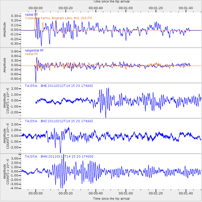
I35A Creekview Farms, Bingham Lake, MN, USA - Earthquake Result Viewer
*The percent match for this event was below the threshold and hence no stack was calculated.
| Earthquake location: |
Near East Coast Of Honshu, Japan |
| Earthquake latitude/longitude: |
38.8/142.5 |
| Earthquake time(UTC): |
2011/03/12 (071) 14:03:31 GMT |
| Earthquake Depth: |
35 km |
| Earthquake Magnitude: |
5.8 MB, 5.3 MS, 5.6 MW |
| Earthquake Catalog/Contributor: |
WHDF/NEIC |
|
| Network: |
TA USArray Transportable Network (new EarthScope stations) |
| Station: |
I35A Creekview Farms, Bingham Lake, MN, USA |
| Lat/Lon: |
43.86 N/94.98 W |
| Elevation: |
428 m |
|
| Distance: |
82.7 deg |
| Az: |
37.976 deg |
| Baz: |
318.338 deg |
| Ray Param: |
$rayparam |
*The percent match for this event was below the threshold and hence was not used in the summary stack. |
|
| Radial Match: |
63.64825 % |
| Radial Bump: |
400 |
| Transverse Match: |
63.495766 % |
| Transverse Bump: |
400 |
| SOD ConfigId: |
356183 |
| Insert Time: |
2011-08-20 02:40:47.993 +0000 |
| GWidth: |
2.5 |
| Max Bumps: |
400 |
| Tol: |
0.001 |
|
Signal To Noise
| Channel | StoN | STA | LTA |
| TA:I35A: :BHZ:20110312T14:15:20.17499Z | 0.7473324 | 2.2314663E-7 | 2.985909E-7 |
| TA:I35A: :BHN:20110312T14:15:20.17499Z | 1.3843753 | 3.694837E-7 | 2.668956E-7 |
| TA:I35A: :BHE:20110312T14:15:20.17499Z | 1.2078404 | 2.9414176E-7 | 2.4352698E-7 |
| Arrivals |
| Ps | |
| PpPs | |
| PsPs/PpSs | |


