You are here: Home > Network List > US - United States National Seismic Network Stations List
> Station ACSO Alum Creek State Park, Ohio, USA > Earthquake Result Viewer
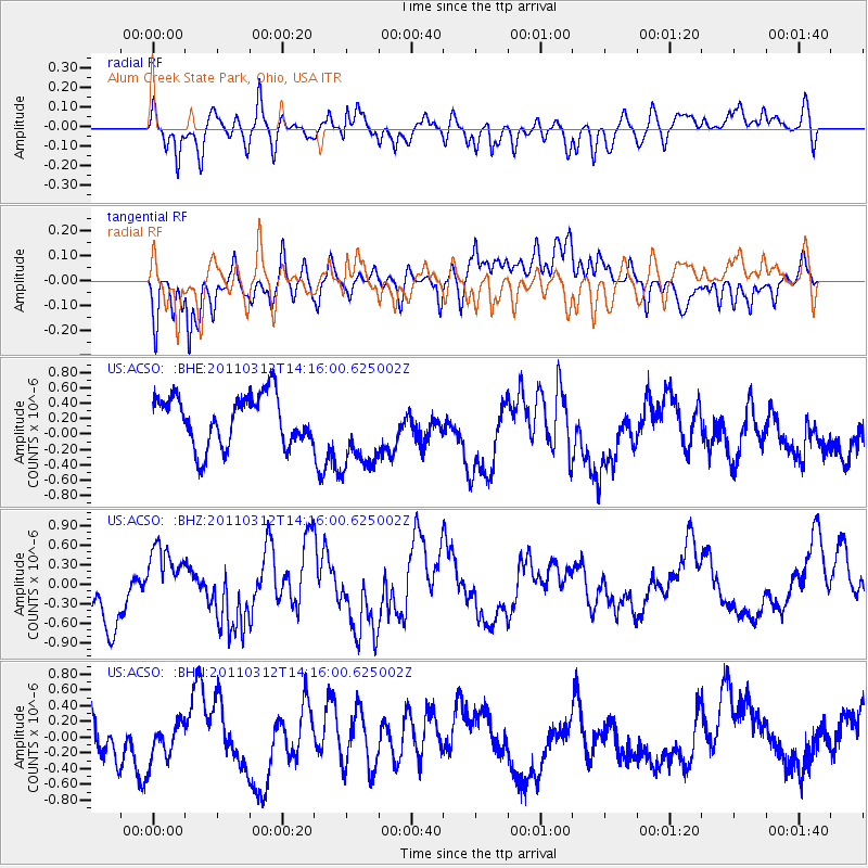
ACSO Alum Creek State Park, Ohio, USA - Earthquake Result Viewer
*The percent match for this event was below the threshold and hence no stack was calculated.
| Earthquake location: |
Near East Coast Of Honshu, Japan |
| Earthquake latitude/longitude: |
38.8/142.5 |
| Earthquake time(UTC): |
2011/03/12 (071) 14:03:31 GMT |
| Earthquake Depth: |
35 km |
| Earthquake Magnitude: |
5.8 MB, 5.3 MS, 5.6 MW |
| Earthquake Catalog/Contributor: |
WHDF/NEIC |
|
| Network: |
US United States National Seismic Network |
| Station: |
ACSO Alum Creek State Park, Ohio, USA |
| Lat/Lon: |
40.23 N/82.98 W |
| Elevation: |
288 m |
|
| Distance: |
91.0 deg |
| Az: |
33.122 deg |
| Baz: |
326.098 deg |
| Ray Param: |
$rayparam |
*The percent match for this event was below the threshold and hence was not used in the summary stack. |
|
| Radial Match: |
59.016296 % |
| Radial Bump: |
400 |
| Transverse Match: |
62.308002 % |
| Transverse Bump: |
400 |
| SOD ConfigId: |
356183 |
| Insert Time: |
2011-08-20 02:53:38.060 +0000 |
| GWidth: |
2.5 |
| Max Bumps: |
400 |
| Tol: |
0.001 |
|
Signal To Noise
| Channel | StoN | STA | LTA |
| US:ACSO: :BHZ:20110312T14:16:00.625002Z | 1.183918 | 5.04615E-7 | 4.2622463E-7 |
| US:ACSO: :BHN:20110312T14:16:00.625002Z | 0.76451844 | 2.4030894E-7 | 3.143272E-7 |
| US:ACSO: :BHE:20110312T14:16:00.625002Z | 1.6328723 | 5.303345E-7 | 3.2478627E-7 |
| Arrivals |
| Ps | |
| PpPs | |
| PsPs/PpSs | |


