You are here: Home > Network List > TA - USArray Transportable Network (new EarthScope stations) Stations List
> Station 933A Laredo, TX, USA > Earthquake Result Viewer
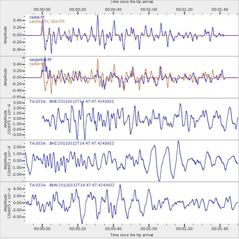
933A Laredo, TX, USA - Earthquake Result Viewer
*The percent match for this event was below the threshold and hence no stack was calculated.
| Earthquake location: |
Near East Coast Of Honshu, Japan |
| Earthquake latitude/longitude: |
35.8/141.7 |
| Earthquake time(UTC): |
2011/03/12 (071) 14:35:01 GMT |
| Earthquake Depth: |
35 km |
| Earthquake Magnitude: |
5.6 MB |
| Earthquake Catalog/Contributor: |
WHDF/NEIC |
|
| Network: |
TA USArray Transportable Network (new EarthScope stations) |
| Station: |
933A Laredo, TX, USA |
| Lat/Lon: |
27.61 N/99.27 W |
| Elevation: |
214 m |
|
| Distance: |
94.7 deg |
| Az: |
51.102 deg |
| Baz: |
314.505 deg |
| Ray Param: |
$rayparam |
*The percent match for this event was below the threshold and hence was not used in the summary stack. |
|
| Radial Match: |
36.245678 % |
| Radial Bump: |
400 |
| Transverse Match: |
42.324135 % |
| Transverse Bump: |
400 |
| SOD ConfigId: |
356183 |
| Insert Time: |
2011-08-20 03:47:32.595 +0000 |
| GWidth: |
2.5 |
| Max Bumps: |
400 |
| Tol: |
0.001 |
|
Signal To Noise
| Channel | StoN | STA | LTA |
| TA:933A: :BHZ:20110312T14:47:47.424993Z | 0.7475379 | 6.1433985E-7 | 8.218177E-7 |
| TA:933A: :BHN:20110312T14:47:47.424993Z | 1.2503653 | 1.1880187E-6 | 9.501373E-7 |
| TA:933A: :BHE:20110312T14:47:47.424993Z | 0.64920336 | 9.035769E-7 | 1.3918242E-6 |
| Arrivals |
| Ps | |
| PpPs | |
| PsPs/PpSs | |


