You are here: Home > Network List > TA - USArray Transportable Network (new EarthScope stations) Stations List
> Station E31A Nome, ND, USA > Earthquake Result Viewer
E31A Nome, ND, USA - Earthquake Result Viewer
*The percent match for this event was below the threshold and hence no stack was calculated.
| Earthquake location: |
Near East Coast Of Honshu, Japan |
| Earthquake latitude/longitude: |
35.8/141.7 |
| Earthquake time(UTC): |
2011/03/12 (071) 14:35:01 GMT |
| Earthquake Depth: |
35 km |
| Earthquake Magnitude: |
5.6 MB |
| Earthquake Catalog/Contributor: |
WHDF/NEIC |
|
| Network: |
TA USArray Transportable Network (new EarthScope stations) |
| Station: |
E31A Nome, ND, USA |
| Lat/Lon: |
46.56 N/97.89 W |
| Elevation: |
427 m |
|
| Distance: |
82.1 deg |
| Az: |
36.907 deg |
| Baz: |
314.955 deg |
| Ray Param: |
$rayparam |
*The percent match for this event was below the threshold and hence was not used in the summary stack. |
|
| Radial Match: |
57.54868 % |
| Radial Bump: |
400 |
| Transverse Match: |
57.442116 % |
| Transverse Bump: |
400 |
| SOD ConfigId: |
356183 |
| Insert Time: |
2011-08-20 03:53:46.760 +0000 |
| GWidth: |
2.5 |
| Max Bumps: |
400 |
| Tol: |
0.001 |
|
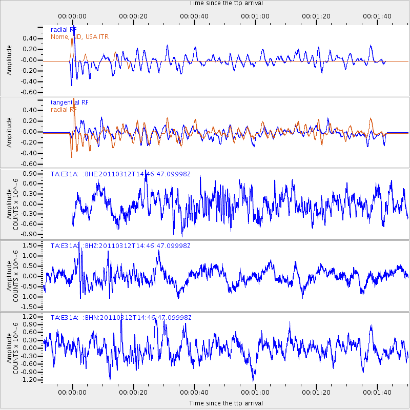
Signal To Noise
| Channel | StoN | STA | LTA |
| TA:E31A: :BHZ:20110312T14:46:47.09998Z | 2.7172248 | 6.560497E-7 | 2.4144106E-7 |
| TA:E31A: :BHN:20110312T14:46:47.09998Z | 1.0185883 | 2.7513798E-7 | 2.7011694E-7 |
| TA:E31A: :BHE:20110312T14:46:47.09998Z | 0.9630096 | 3.1935096E-7 | 3.3161766E-7 |
| Arrivals |
| Ps | |
| PpPs | |
| PsPs/PpSs | |


