You are here: Home > Network List > TA - USArray Transportable Network (new EarthScope stations) Stations List
> Station I38A Scanlan Farm, Eyota, MN, USA > Earthquake Result Viewer
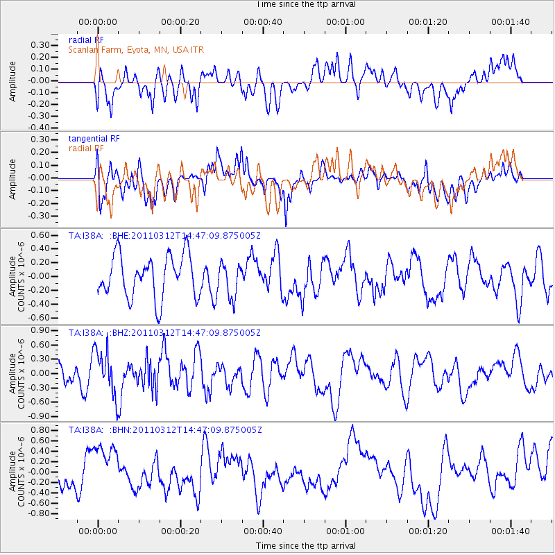
I38A Scanlan Farm, Eyota, MN, USA - Earthquake Result Viewer
*The percent match for this event was below the threshold and hence no stack was calculated.
| Earthquake location: |
Near East Coast Of Honshu, Japan |
| Earthquake latitude/longitude: |
35.8/141.7 |
| Earthquake time(UTC): |
2011/03/12 (071) 14:35:01 GMT |
| Earthquake Depth: |
35 km |
| Earthquake Magnitude: |
5.6 MB |
| Earthquake Catalog/Contributor: |
WHDF/NEIC |
|
| Network: |
TA USArray Transportable Network (new EarthScope stations) |
| Station: |
I38A Scanlan Farm, Eyota, MN, USA |
| Lat/Lon: |
44.04 N/92.33 W |
| Elevation: |
390 m |
|
| Distance: |
86.6 deg |
| Az: |
35.76 deg |
| Baz: |
318.782 deg |
| Ray Param: |
$rayparam |
*The percent match for this event was below the threshold and hence was not used in the summary stack. |
|
| Radial Match: |
61.448067 % |
| Radial Bump: |
400 |
| Transverse Match: |
54.711246 % |
| Transverse Bump: |
400 |
| SOD ConfigId: |
356183 |
| Insert Time: |
2011-08-20 03:57:18.001 +0000 |
| GWidth: |
2.5 |
| Max Bumps: |
400 |
| Tol: |
0.001 |
|
Signal To Noise
| Channel | StoN | STA | LTA |
| TA:I38A: :BHZ:20110312T14:47:09.875005Z | 1.7912323 | 4.7650363E-7 | 2.6602E-7 |
| TA:I38A: :BHN:20110312T14:47:09.875005Z | 1.778093 | 4.7679222E-7 | 2.6814809E-7 |
| TA:I38A: :BHE:20110312T14:47:09.875005Z | 0.81232655 | 2.4977146E-7 | 3.0747665E-7 |
| Arrivals |
| Ps | |
| PpPs | |
| PsPs/PpSs | |


