You are here: Home > Network List > TA - USArray Transportable Network (new EarthScope stations) Stations List
> Station H46A Fife Lake, MI, USA > Earthquake Result Viewer
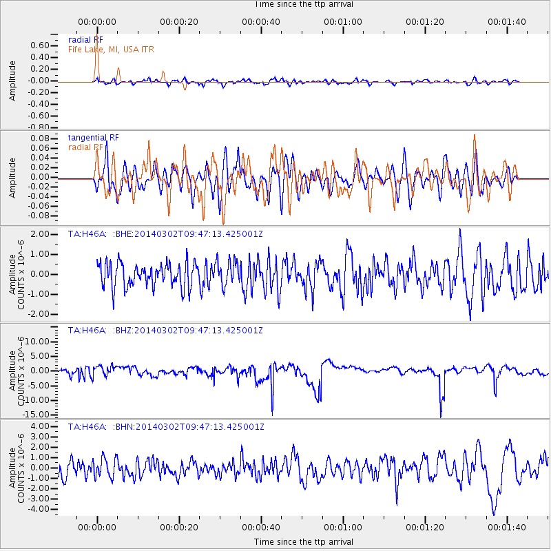
H46A Fife Lake, MI, USA - Earthquake Result Viewer
*The percent match for this event was below the threshold and hence no stack was calculated.
| Earthquake location: |
Near Coast Of Nicaragua |
| Earthquake latitude/longitude: |
12.4/-87.9 |
| Earthquake time(UTC): |
2014/03/02 (061) 09:41:21 GMT |
| Earthquake Depth: |
50 km |
| Earthquake Magnitude: |
5.0 mb |
| Earthquake Catalog/Contributor: |
ISC/ISC |
|
| Network: |
TA USArray Transportable Network (new EarthScope stations) |
| Station: |
H46A Fife Lake, MI, USA |
| Lat/Lon: |
44.54 N/85.20 W |
| Elevation: |
329 m |
|
| Distance: |
32.1 deg |
| Az: |
3.613 deg |
| Baz: |
184.939 deg |
| Ray Param: |
$rayparam |
*The percent match for this event was below the threshold and hence was not used in the summary stack. |
|
| Radial Match: |
47.782715 % |
| Radial Bump: |
400 |
| Transverse Match: |
54.36015 % |
| Transverse Bump: |
400 |
| SOD ConfigId: |
3390531 |
| Insert Time: |
2019-04-10 11:26:38.366 +0000 |
| GWidth: |
2.5 |
| Max Bumps: |
400 |
| Tol: |
0.001 |
|
Signal To Noise
| Channel | StoN | STA | LTA |
| TA:H46A: :BHZ:20140302T09:47:13.425001Z | 0.5967324 | 2.330648E-6 | 3.9056836E-6 |
| TA:H46A: :BHN:20140302T09:47:13.425001Z | 1.5170469 | 9.2513284E-7 | 6.098248E-7 |
| TA:H46A: :BHE:20140302T09:47:13.425001Z | 1.068634 | 6.228845E-7 | 5.828791E-7 |
| Arrivals |
| Ps | |
| PpPs | |
| PsPs/PpSs | |


