You are here: Home > Network List > TA - USArray Transportable Network (new EarthScope stations) Stations List
> Station A29A Manning Farm, Rocklake, ND, USA > Earthquake Result Viewer
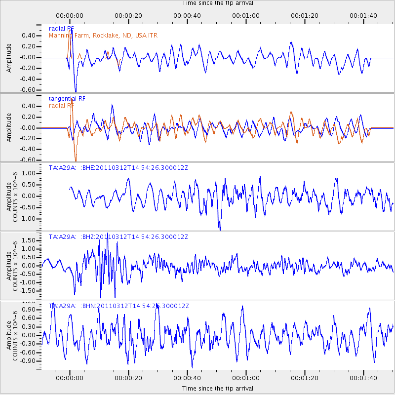
A29A Manning Farm, Rocklake, ND, USA - Earthquake Result Viewer
*The percent match for this event was below the threshold and hence no stack was calculated.
| Earthquake location: |
Near East Coast Of Honshu, Japan |
| Earthquake latitude/longitude: |
39.5/142.4 |
| Earthquake time(UTC): |
2011/03/12 (071) 14:43:10 GMT |
| Earthquake Depth: |
35 km |
| Earthquake Magnitude: |
5.7 MB, 5.5 MS, 5.8 MW |
| Earthquake Catalog/Contributor: |
WHDF/NEIC |
|
| Network: |
TA USArray Transportable Network (new EarthScope stations) |
| Station: |
A29A Manning Farm, Rocklake, ND, USA |
| Lat/Lon: |
48.92 N/99.23 W |
| Elevation: |
480 m |
|
| Distance: |
76.5 deg |
| Az: |
36.646 deg |
| Baz: |
315.533 deg |
| Ray Param: |
$rayparam |
*The percent match for this event was below the threshold and hence was not used in the summary stack. |
|
| Radial Match: |
60.662643 % |
| Radial Bump: |
400 |
| Transverse Match: |
59.426678 % |
| Transverse Bump: |
400 |
| SOD ConfigId: |
356183 |
| Insert Time: |
2011-08-20 04:55:39.573 +0000 |
| GWidth: |
2.5 |
| Max Bumps: |
400 |
| Tol: |
0.001 |
|
Signal To Noise
| Channel | StoN | STA | LTA |
| TA:A29A: :BHZ:20110312T14:54:26.300012Z | 3.6830595 | 6.6266017E-7 | 1.799211E-7 |
| TA:A29A: :BHN:20110312T14:54:26.300012Z | 0.94113743 | 3.9226668E-7 | 4.1680065E-7 |
| TA:A29A: :BHE:20110312T14:54:26.300012Z | 1.1038641 | 3.2057093E-7 | 2.90408E-7 |
| Arrivals |
| Ps | |
| PpPs | |
| PsPs/PpSs | |


