You are here: Home > Network List > CI - Caltech Regional Seismic Network Stations List
> Station MPM Manuel Prospect Mine, California, USA > Earthquake Result Viewer
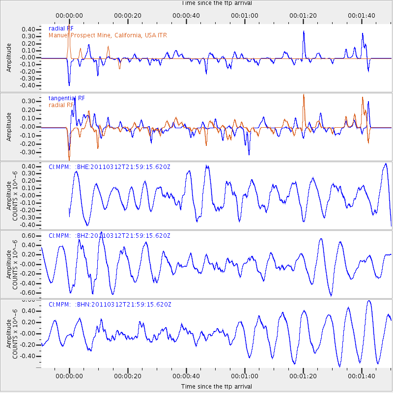
MPM Manuel Prospect Mine, California, USA - Earthquake Result Viewer
*The percent match for this event was below the threshold and hence no stack was calculated.
| Earthquake location: |
Near East Coast Of Honshu, Japan |
| Earthquake latitude/longitude: |
39.6/142.6 |
| Earthquake time(UTC): |
2011/03/12 (071) 21:48:09 GMT |
| Earthquake Depth: |
26 km |
| Earthquake Magnitude: |
5.5 MB, 5.3 MS, 5.6 MW |
| Earthquake Catalog/Contributor: |
WHDF/NEIC |
|
| Network: |
CI Caltech Regional Seismic Network |
| Station: |
MPM Manuel Prospect Mine, California, USA |
| Lat/Lon: |
36.06 N/117.49 W |
| Elevation: |
185 m |
|
| Distance: |
74.7 deg |
| Az: |
55.843 deg |
| Baz: |
307.919 deg |
| Ray Param: |
$rayparam |
*The percent match for this event was below the threshold and hence was not used in the summary stack. |
|
| Radial Match: |
58.159687 % |
| Radial Bump: |
400 |
| Transverse Match: |
68.51878 % |
| Transverse Bump: |
400 |
| SOD ConfigId: |
356183 |
| Insert Time: |
2011-08-20 06:18:47.338 +0000 |
| GWidth: |
2.5 |
| Max Bumps: |
400 |
| Tol: |
0.001 |
|
Signal To Noise
| Channel | StoN | STA | LTA |
| CI:MPM: :BHZ:20110312T21:59:15.620Z | 1.9058512 | 3.938628E-7 | 2.0665978E-7 |
| CI:MPM: :BHN:20110312T21:59:15.620Z | 0.7493503 | 1.5619874E-7 | 2.0844556E-7 |
| CI:MPM: :BHE:20110312T21:59:15.620Z | 0.5437958 | 9.259515E-8 | 1.7027558E-7 |
| Arrivals |
| Ps | |
| PpPs | |
| PsPs/PpSs | |


