You are here: Home > Network List > TA - USArray Transportable Network (new EarthScope stations) Stations List
> Station 534A Blanco, TX, USA > Earthquake Result Viewer
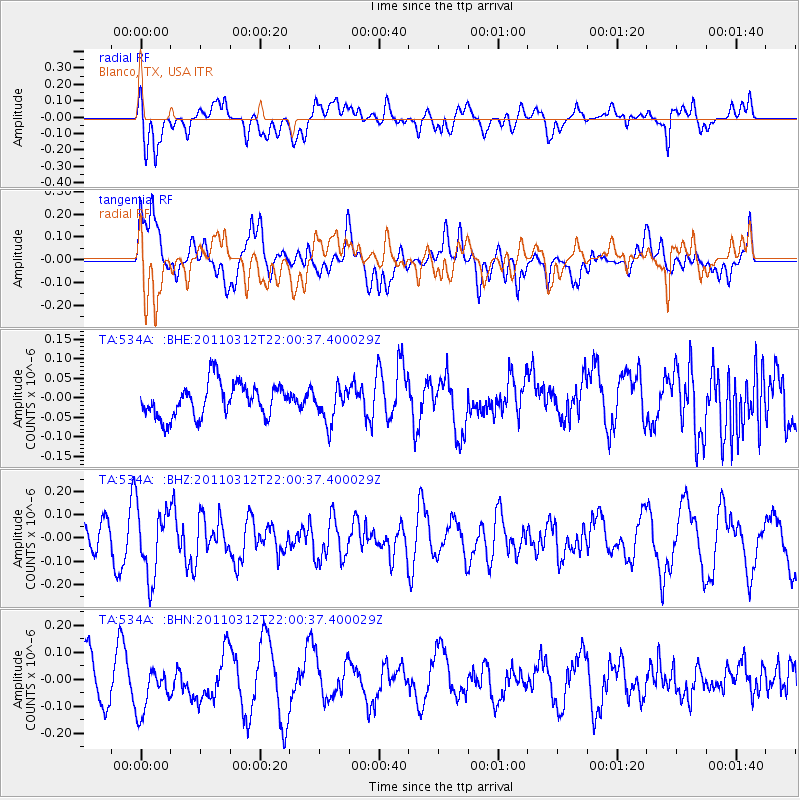
534A Blanco, TX, USA - Earthquake Result Viewer
*The percent match for this event was below the threshold and hence no stack was calculated.
| Earthquake location: |
Near East Coast Of Honshu, Japan |
| Earthquake latitude/longitude: |
39.6/142.6 |
| Earthquake time(UTC): |
2011/03/12 (071) 21:48:09 GMT |
| Earthquake Depth: |
26 km |
| Earthquake Magnitude: |
5.5 MB, 5.3 MS, 5.6 MW |
| Earthquake Catalog/Contributor: |
WHDF/NEIC |
|
| Network: |
TA USArray Transportable Network (new EarthScope stations) |
| Station: |
534A Blanco, TX, USA |
| Lat/Lon: |
30.03 N/98.48 W |
| Elevation: |
461 m |
|
| Distance: |
90.5 deg |
| Az: |
49.362 deg |
| Baz: |
317.473 deg |
| Ray Param: |
$rayparam |
*The percent match for this event was below the threshold and hence was not used in the summary stack. |
|
| Radial Match: |
53.000874 % |
| Radial Bump: |
400 |
| Transverse Match: |
45.39062 % |
| Transverse Bump: |
400 |
| SOD ConfigId: |
356183 |
| Insert Time: |
2011-08-20 06:46:13.633 +0000 |
| GWidth: |
2.5 |
| Max Bumps: |
400 |
| Tol: |
0.001 |
|
Signal To Noise
| Channel | StoN | STA | LTA |
| TA:534A: :BHZ:20110312T22:00:37.400029Z | 1.6665288 | 1.4740766E-7 | 8.8451905E-8 |
| TA:534A: :BHN:20110312T22:00:37.400029Z | 1.2869257 | 8.735898E-8 | 6.788191E-8 |
| TA:534A: :BHE:20110312T22:00:37.400029Z | 1.0426966 | 4.4538687E-8 | 4.2714905E-8 |
| Arrivals |
| Ps | |
| PpPs | |
| PsPs/PpSs | |


