You are here: Home > Network List > TA - USArray Transportable Network (new EarthScope stations) Stations List
> Station O35A Humboldt, NE, USA > Earthquake Result Viewer
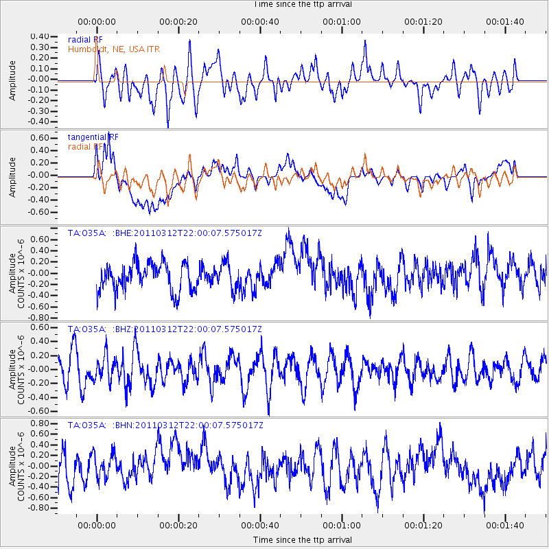
O35A Humboldt, NE, USA - Earthquake Result Viewer
*The percent match for this event was below the threshold and hence no stack was calculated.
| Earthquake location: |
Near East Coast Of Honshu, Japan |
| Earthquake latitude/longitude: |
39.6/142.6 |
| Earthquake time(UTC): |
2011/03/12 (071) 21:48:09 GMT |
| Earthquake Depth: |
26 km |
| Earthquake Magnitude: |
5.5 MB, 5.3 MS, 5.6 MW |
| Earthquake Catalog/Contributor: |
WHDF/NEIC |
|
| Network: |
TA USArray Transportable Network (new EarthScope stations) |
| Station: |
O35A Humboldt, NE, USA |
| Lat/Lon: |
40.27 N/95.91 W |
| Elevation: |
342 m |
|
| Distance: |
84.3 deg |
| Az: |
40.961 deg |
| Baz: |
318.563 deg |
| Ray Param: |
$rayparam |
*The percent match for this event was below the threshold and hence was not used in the summary stack. |
|
| Radial Match: |
53.50609 % |
| Radial Bump: |
400 |
| Transverse Match: |
40.50857 % |
| Transverse Bump: |
400 |
| SOD ConfigId: |
356183 |
| Insert Time: |
2011-08-20 06:50:27.073 +0000 |
| GWidth: |
2.5 |
| Max Bumps: |
400 |
| Tol: |
0.001 |
|
Signal To Noise
| Channel | StoN | STA | LTA |
| TA:O35A: :BHZ:20110312T22:00:07.575017Z | 0.904219 | 1.7669434E-7 | 1.9541099E-7 |
| TA:O35A: :BHN:20110312T22:00:07.575017Z | 1.0827786 | 2.6359004E-7 | 2.4343854E-7 |
| TA:O35A: :BHE:20110312T22:00:07.575017Z | 0.96933395 | 2.3848693E-7 | 2.4603173E-7 |
| Arrivals |
| Ps | |
| PpPs | |
| PsPs/PpSs | |


