You are here: Home > Network List > CI - Caltech Regional Seismic Network Stations List
> Station MPM Manuel Prospect Mine, California, USA > Earthquake Result Viewer
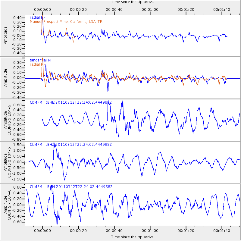
MPM Manuel Prospect Mine, California, USA - Earthquake Result Viewer
*The percent match for this event was below the threshold and hence no stack was calculated.
| Earthquake location: |
Near East Coast Of Honshu, Japan |
| Earthquake latitude/longitude: |
37.7/141.9 |
| Earthquake time(UTC): |
2011/03/12 (071) 22:12:46 GMT |
| Earthquake Depth: |
16 km |
| Earthquake Magnitude: |
5.9 MB, 5.5 MS, 5.9 MW, 5.8 MW |
| Earthquake Catalog/Contributor: |
WHDF/NEIC |
|
| Network: |
CI Caltech Regional Seismic Network |
| Station: |
MPM Manuel Prospect Mine, California, USA |
| Lat/Lon: |
36.06 N/117.49 W |
| Elevation: |
185 m |
|
| Distance: |
76.2 deg |
| Az: |
55.086 deg |
| Baz: |
306.59 deg |
| Ray Param: |
$rayparam |
*The percent match for this event was below the threshold and hence was not used in the summary stack. |
|
| Radial Match: |
49.319347 % |
| Radial Bump: |
393 |
| Transverse Match: |
74.56184 % |
| Transverse Bump: |
400 |
| SOD ConfigId: |
356183 |
| Insert Time: |
2011-08-20 07:25:53.222 +0000 |
| GWidth: |
2.5 |
| Max Bumps: |
400 |
| Tol: |
0.001 |
|
Signal To Noise
| Channel | StoN | STA | LTA |
| CI:MPM: :BHZ:20110312T22:24:02.444988Z | 3.1991725 | 4.1805123E-7 | 1.306748E-7 |
| CI:MPM: :BHN:20110312T22:24:02.444988Z | 1.1554484 | 3.1754215E-7 | 2.748216E-7 |
| CI:MPM: :BHE:20110312T22:24:02.444988Z | 1.6089481 | 2.4218176E-7 | 1.5052179E-7 |
| Arrivals |
| Ps | |
| PpPs | |
| PsPs/PpSs | |


