You are here: Home > Network List > TA - USArray Transportable Network (new EarthScope stations) Stations List
> Station T25A Trinidad, CO, USA > Earthquake Result Viewer
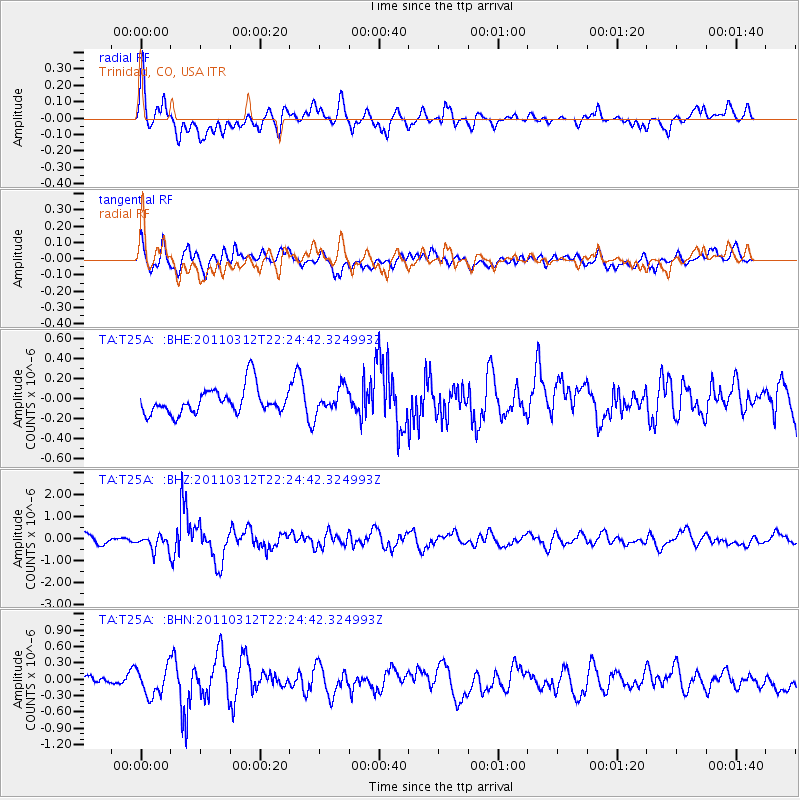
T25A Trinidad, CO, USA - Earthquake Result Viewer
*The percent match for this event was below the threshold and hence no stack was calculated.
| Earthquake location: |
Near East Coast Of Honshu, Japan |
| Earthquake latitude/longitude: |
37.7/141.9 |
| Earthquake time(UTC): |
2011/03/12 (071) 22:12:46 GMT |
| Earthquake Depth: |
16 km |
| Earthquake Magnitude: |
5.9 MB, 5.5 MS, 5.9 MW, 5.8 MW |
| Earthquake Catalog/Contributor: |
WHDF/NEIC |
|
| Network: |
TA USArray Transportable Network (new EarthScope stations) |
| Station: |
T25A Trinidad, CO, USA |
| Lat/Lon: |
37.14 N/104.41 W |
| Elevation: |
2017 m |
|
| Distance: |
83.6 deg |
| Az: |
47.416 deg |
| Baz: |
313.028 deg |
| Ray Param: |
$rayparam |
*The percent match for this event was below the threshold and hence was not used in the summary stack. |
|
| Radial Match: |
67.27941 % |
| Radial Bump: |
400 |
| Transverse Match: |
58.974026 % |
| Transverse Bump: |
400 |
| SOD ConfigId: |
356183 |
| Insert Time: |
2011-08-20 07:54:56.758 +0000 |
| GWidth: |
2.5 |
| Max Bumps: |
400 |
| Tol: |
0.001 |
|
Signal To Noise
| Channel | StoN | STA | LTA |
| TA:T25A: :BHZ:20110312T22:24:42.324993Z | 1.7474092 | 3.3819387E-7 | 1.9354016E-7 |
| TA:T25A: :BHN:20110312T22:24:42.324993Z | 2.37638 | 2.6341286E-7 | 1.1084627E-7 |
| TA:T25A: :BHE:20110312T22:24:42.324993Z | 0.94041866 | 1.2416673E-7 | 1.3203346E-7 |
| Arrivals |
| Ps | |
| PpPs | |
| PsPs/PpSs | |


