You are here: Home > Network List > TA - USArray Transportable Network (new EarthScope stations) Stations List
> Station BGNE Belgrade, NE, USA > Earthquake Result Viewer
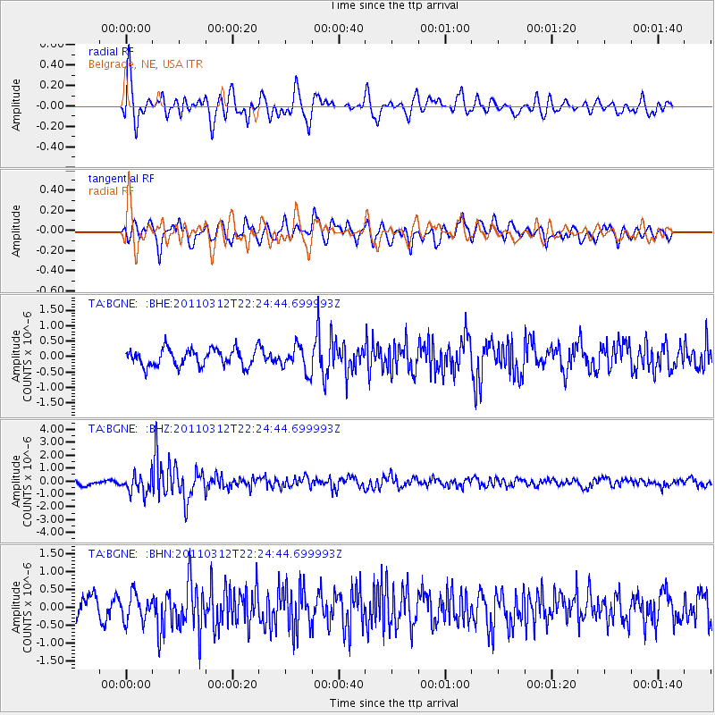
BGNE Belgrade, NE, USA - Earthquake Result Viewer
*The percent match for this event was below the threshold and hence no stack was calculated.
| Earthquake location: |
Near East Coast Of Honshu, Japan |
| Earthquake latitude/longitude: |
37.7/141.9 |
| Earthquake time(UTC): |
2011/03/12 (071) 22:12:46 GMT |
| Earthquake Depth: |
16 km |
| Earthquake Magnitude: |
5.9 MB, 5.5 MS, 5.9 MW, 5.8 MW |
| Earthquake Catalog/Contributor: |
WHDF/NEIC |
|
| Network: |
TA USArray Transportable Network (new EarthScope stations) |
| Station: |
BGNE Belgrade, NE, USA |
| Lat/Lon: |
41.41 N/98.15 W |
| Elevation: |
573 m |
|
| Distance: |
84.1 deg |
| Az: |
40.933 deg |
| Baz: |
316.286 deg |
| Ray Param: |
$rayparam |
*The percent match for this event was below the threshold and hence was not used in the summary stack. |
|
| Radial Match: |
72.282776 % |
| Radial Bump: |
400 |
| Transverse Match: |
67.682 % |
| Transverse Bump: |
400 |
| SOD ConfigId: |
356183 |
| Insert Time: |
2011-08-20 07:57:42.771 +0000 |
| GWidth: |
2.5 |
| Max Bumps: |
400 |
| Tol: |
0.001 |
|
Signal To Noise
| Channel | StoN | STA | LTA |
| TA:BGNE: :BHZ:20110312T22:24:44.699993Z | 3.9578757 | 7.5051156E-7 | 1.8962486E-7 |
| TA:BGNE: :BHN:20110312T22:24:44.699993Z | 1.4760913 | 3.7400147E-7 | 2.5337286E-7 |
| TA:BGNE: :BHE:20110312T22:24:44.699993Z | 1.493391 | 4.1291906E-7 | 2.7649762E-7 |
| Arrivals |
| Ps | |
| PpPs | |
| PsPs/PpSs | |


