
H29A Onida, SD, USA - Earthquake Result Viewer
| ||||||||||||||||||
| ||||||||||||||||||
| ||||||||||||||||||
|
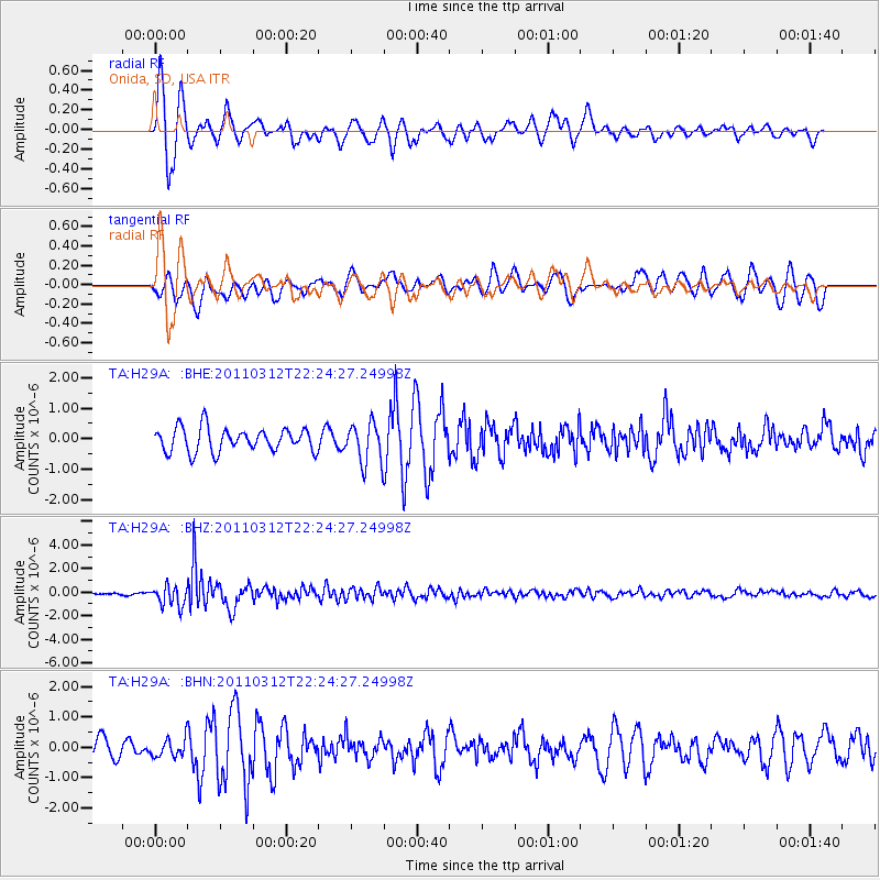
Signal To Noise
| Channel | StoN | STA | LTA |
| TA:H29A: :BHZ:20110312T22:24:27.24998Z | 6.526925 | 8.5539693E-7 | 1.3105665E-7 |
| TA:H29A: :BHN:20110312T22:24:27.24998Z | 0.63454974 | 2.9429006E-7 | 4.6377772E-7 |
| TA:H29A: :BHE:20110312T22:24:27.24998Z | 1.7100352 | 6.598435E-7 | 3.8586546E-7 |
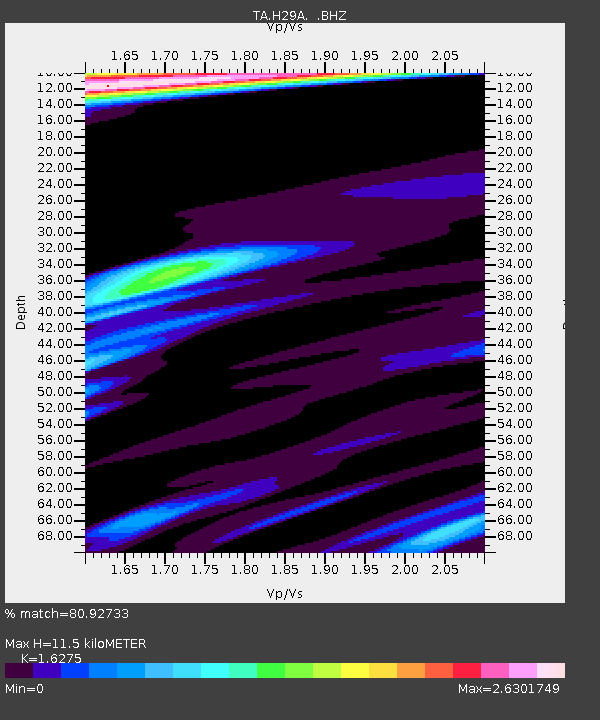
| Arrivals | |
| Ps | 1.1 SECOND |
| PpPs | 4.5 SECOND |
| PsPs/PpSs | 5.6 SECOND |

