You are here: Home > Network List > UW - Pacific Northwest Regional Seismic Network Stations List
> Station LEBA Lebam, WA, USA > Earthquake Result Viewer
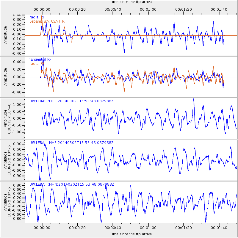
LEBA Lebam, WA, USA - Earthquake Result Viewer
*The percent match for this event was below the threshold and hence no stack was calculated.
| Earthquake location: |
Tonga Islands |
| Earthquake latitude/longitude: |
-21.4/-174.0 |
| Earthquake time(UTC): |
2014/03/02 (061) 15:42:03 GMT |
| Earthquake Depth: |
25 km |
| Earthquake Magnitude: |
5.2 MW |
| Earthquake Catalog/Contributor: |
ISC/ISC |
|
| Network: |
UW Pacific Northwest Regional Seismic Network |
| Station: |
LEBA Lebam, WA, USA |
| Lat/Lon: |
46.55 N/123.56 W |
| Elevation: |
73 m |
|
| Distance: |
81.6 deg |
| Az: |
32.558 deg |
| Baz: |
226.592 deg |
| Ray Param: |
$rayparam |
*The percent match for this event was below the threshold and hence was not used in the summary stack. |
|
| Radial Match: |
47.26694 % |
| Radial Bump: |
400 |
| Transverse Match: |
58.699467 % |
| Transverse Bump: |
400 |
| SOD ConfigId: |
3390531 |
| Insert Time: |
2019-04-10 11:38:24.534 +0000 |
| GWidth: |
2.5 |
| Max Bumps: |
400 |
| Tol: |
0.001 |
|
Signal To Noise
| Channel | StoN | STA | LTA |
| UW:LEBA: :HHZ:20140302T15:53:48.087988Z | 3.4499416 | 6.954093E-7 | 2.0157132E-7 |
| UW:LEBA: :HHN:20140302T15:53:48.087988Z | 1.0697082 | 4.4267045E-7 | 4.1382356E-7 |
| UW:LEBA: :HHE:20140302T15:53:48.087988Z | 1.6241324 | 4.875309E-7 | 3.0017927E-7 |
| Arrivals |
| Ps | |
| PpPs | |
| PsPs/PpSs | |


