You are here: Home > Network List > TA - USArray Transportable Network (new EarthScope stations) Stations List
> Station N59A State Game Land 141, Hazleton, PA, USA > Earthquake Result Viewer
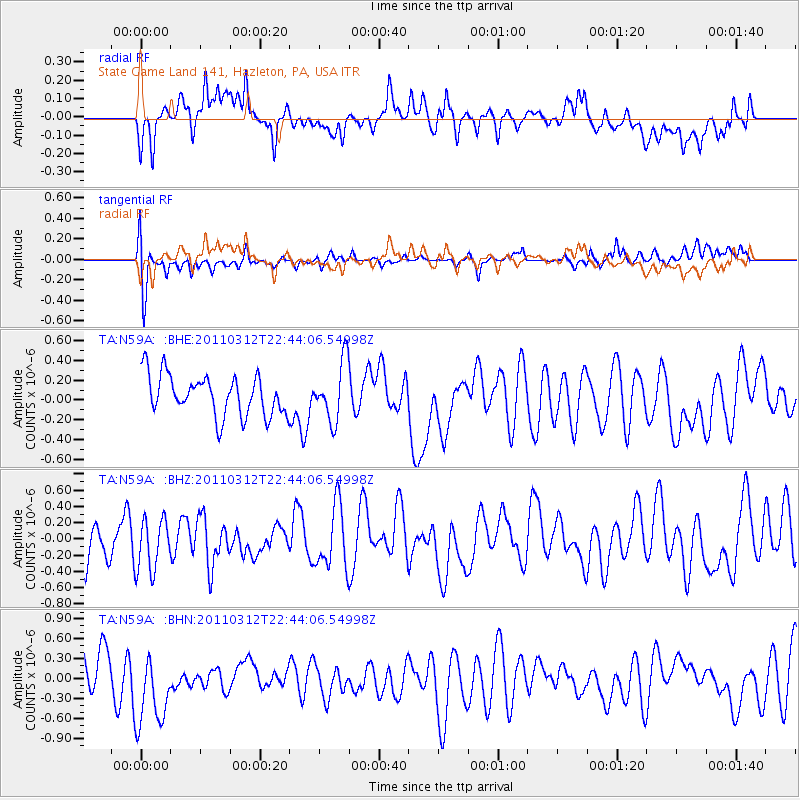
N59A State Game Land 141, Hazleton, PA, USA - Earthquake Result Viewer
*The percent match for this event was below the threshold and hence no stack was calculated.
| Earthquake location: |
Near East Coast Of Honshu, Japan |
| Earthquake latitude/longitude: |
39.2/142.3 |
| Earthquake time(UTC): |
2011/03/12 (071) 22:31:27 GMT |
| Earthquake Depth: |
31 km |
| Earthquake Magnitude: |
5.5 MB, 5.3 MS, 5.3 MW |
| Earthquake Catalog/Contributor: |
WHDF/NEIC |
|
| Network: |
TA USArray Transportable Network (new EarthScope stations) |
| Station: |
N59A State Game Land 141, Hazleton, PA, USA |
| Lat/Lon: |
40.92 N/75.77 W |
| Elevation: |
508 m |
|
| Distance: |
93.1 deg |
| Az: |
27.882 deg |
| Baz: |
331.336 deg |
| Ray Param: |
$rayparam |
*The percent match for this event was below the threshold and hence was not used in the summary stack. |
|
| Radial Match: |
44.252533 % |
| Radial Bump: |
400 |
| Transverse Match: |
57.601086 % |
| Transverse Bump: |
400 |
| SOD ConfigId: |
356183 |
| Insert Time: |
2011-08-20 11:09:59.545 +0000 |
| GWidth: |
2.5 |
| Max Bumps: |
400 |
| Tol: |
0.001 |
|
Signal To Noise
| Channel | StoN | STA | LTA |
| TA:N59A: :BHZ:20110312T22:44:06.54998Z | 1.308342 | 3.1746487E-7 | 2.426467E-7 |
| TA:N59A: :BHN:20110312T22:44:06.54998Z | 1.5630051 | 5.7290623E-7 | 3.6654149E-7 |
| TA:N59A: :BHE:20110312T22:44:06.54998Z | 1.4536158 | 2.977998E-7 | 2.048683E-7 |
| Arrivals |
| Ps | |
| PpPs | |
| PsPs/PpSs | |


