You are here: Home > Network List > TA - USArray Transportable Network (new EarthScope stations) Stations List
> Station SFIN Lafayette, IN, USA > Earthquake Result Viewer
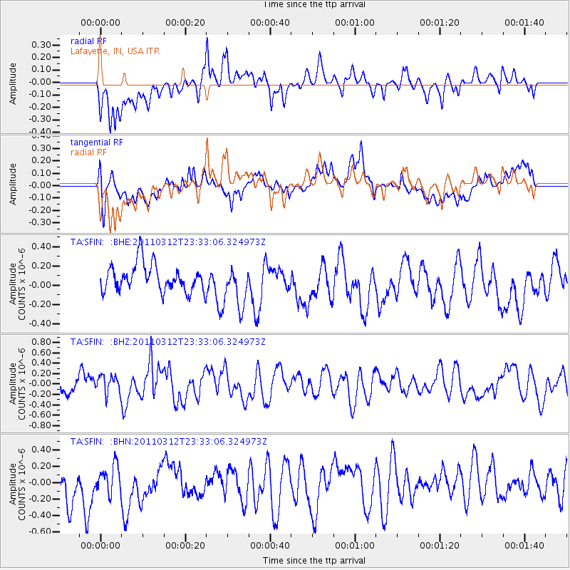
SFIN Lafayette, IN, USA - Earthquake Result Viewer
*The percent match for this event was below the threshold and hence no stack was calculated.
| Earthquake location: |
Off East Coast Of Honshu, Japan |
| Earthquake latitude/longitude: |
38.0/142.3 |
| Earthquake time(UTC): |
2011/03/12 (071) 23:20:41 GMT |
| Earthquake Depth: |
24 km |
| Earthquake Magnitude: |
5.6 MS, 5.3 MB |
| Earthquake Catalog/Contributor: |
WHDF/NEIC |
|
| Network: |
TA USArray Transportable Network (new EarthScope stations) |
| Station: |
SFIN Lafayette, IN, USA |
| Lat/Lon: |
40.38 N/87.10 W |
| Elevation: |
165 m |
|
| Distance: |
89.8 deg |
| Az: |
35.439 deg |
| Baz: |
323.154 deg |
| Ray Param: |
$rayparam |
*The percent match for this event was below the threshold and hence was not used in the summary stack. |
|
| Radial Match: |
59.823425 % |
| Radial Bump: |
400 |
| Transverse Match: |
57.16832 % |
| Transverse Bump: |
400 |
| SOD ConfigId: |
356183 |
| Insert Time: |
2011-08-20 12:12:50.225 +0000 |
| GWidth: |
2.5 |
| Max Bumps: |
400 |
| Tol: |
0.001 |
|
Signal To Noise
| Channel | StoN | STA | LTA |
| TA:SFIN: :BHZ:20110312T23:33:06.324973Z | 1.1021726 | 1.7383671E-7 | 1.5772186E-7 |
| TA:SFIN: :BHN:20110312T23:33:06.324973Z | 0.6911361 | 1.7787222E-7 | 2.5736207E-7 |
| TA:SFIN: :BHE:20110312T23:33:06.324973Z | 1.5780201 | 2.2017498E-7 | 1.395261E-7 |
| Arrivals |
| Ps | |
| PpPs | |
| PsPs/PpSs | |


