KZA KN.KZA - Earthquake Result Viewer
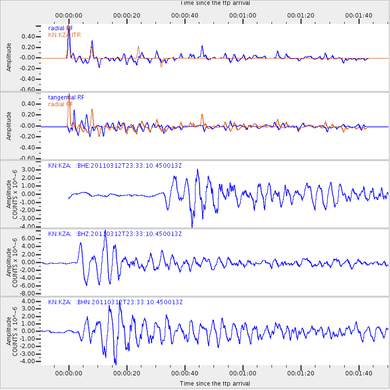
Earthquake location: Near East Coast Of Honshu, Japan
Earthquake latitude/longitude: 38.0/141.7
Earthquake time(UTC): 2011/03/12 (071) 23:24:48 GMT
Earthquake Depth: 15 km
Earthquake Magnitude: 6.0 MB, 5.6 MS, 6.1 MW, 5.9 MW
Earthquake Catalog/Contributor: WHDF/NEIC
Network: KN Kyrgyz Seismic Telemetry Network
Station: KZA KN.KZA
Lat/Lon: 42.08 N/75.25 E
Elevation: 3520 m
Distance: 49.9 deg
Az: 296.795 deg
Baz: 71.197 deg
Ray Param: 0.06840821
Estimated Moho Depth: 60.25 km
Estimated Crust Vp/Vs: 1.81
Assumed Crust Vp: 6.306 km/s
Estimated Crust Vs: 3.494 km/s
Estimated Crust Poisson's Ratio: 0.28
Radial Match: 96.059616 %
Radial Bump: 382
Transverse Match: 94.0768 %
Transverse Bump: 400
SOD ConfigId: 356183
Insert Time: 2011-08-20 13:10:57.240 +0000
GWidth: 2.5
Max Bumps: 400
Tol: 0.001

Signal To Noise

ChannelStoNSTALTA
KN:KZA: :BHZ:20110312T23:33:10.450013Z15.8223091.9484091E-61.2314317E-7
KN:KZA: :BHN:20110312T23:33:10.450013Z3.48007974.5718403E-71.3137172E-7
KN:KZA: :BHE:20110312T23:33:10.450013Z4.8979377.120072E-71.4536879E-7
Arrivals
Ps8.1 SECOND
PpPs25 SECOND
PsPs/PpSs33 SECOND