You are here: Home > Network List > MN - MEDNET Project Stations List
> Station IDI Anogia, Greece > Earthquake Result Viewer
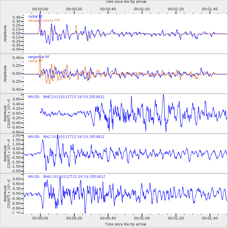
IDI Anogia, Greece - Earthquake Result Viewer
*The percent match for this event was below the threshold and hence no stack was calculated.
| Earthquake location: |
Near East Coast Of Honshu, Japan |
| Earthquake latitude/longitude: |
38.0/141.7 |
| Earthquake time(UTC): |
2011/03/12 (071) 23:24:48 GMT |
| Earthquake Depth: |
15 km |
| Earthquake Magnitude: |
6.0 MB, 5.6 MS, 6.1 MW, 5.9 MW |
| Earthquake Catalog/Contributor: |
WHDF/NEIC |
|
| Network: |
MN MEDNET Project |
| Station: |
IDI Anogia, Greece |
| Lat/Lon: |
35.29 N/24.89 E |
| Elevation: |
750 m |
|
| Distance: |
86.5 deg |
| Az: |
312.996 deg |
| Baz: |
44.898 deg |
| Ray Param: |
$rayparam |
*The percent match for this event was below the threshold and hence was not used in the summary stack. |
|
| Radial Match: |
64.80105 % |
| Radial Bump: |
400 |
| Transverse Match: |
71.86639 % |
| Transverse Bump: |
400 |
| SOD ConfigId: |
356183 |
| Insert Time: |
2011-08-20 13:15:18.518 +0000 |
| GWidth: |
2.5 |
| Max Bumps: |
400 |
| Tol: |
0.001 |
|
Signal To Noise
| Channel | StoN | STA | LTA |
| MN:IDI: :BHZ:20110312T23:36:59.285981Z | 14.68445 | 9.023423E-7 | 6.144884E-8 |
| MN:IDI: :BHN:20110312T23:36:59.285981Z | 8.338918 | 5.0212134E-7 | 6.021421E-8 |
| MN:IDI: :BHE:20110312T23:36:59.285981Z | 3.8751874 | 2.4857178E-7 | 6.414445E-8 |
| Arrivals |
| Ps | |
| PpPs | |
| PsPs/PpSs | |


