You are here: Home > Network List > MN - MEDNET Project Stations List
> Station TIP Timpagrande, Italy > Earthquake Result Viewer
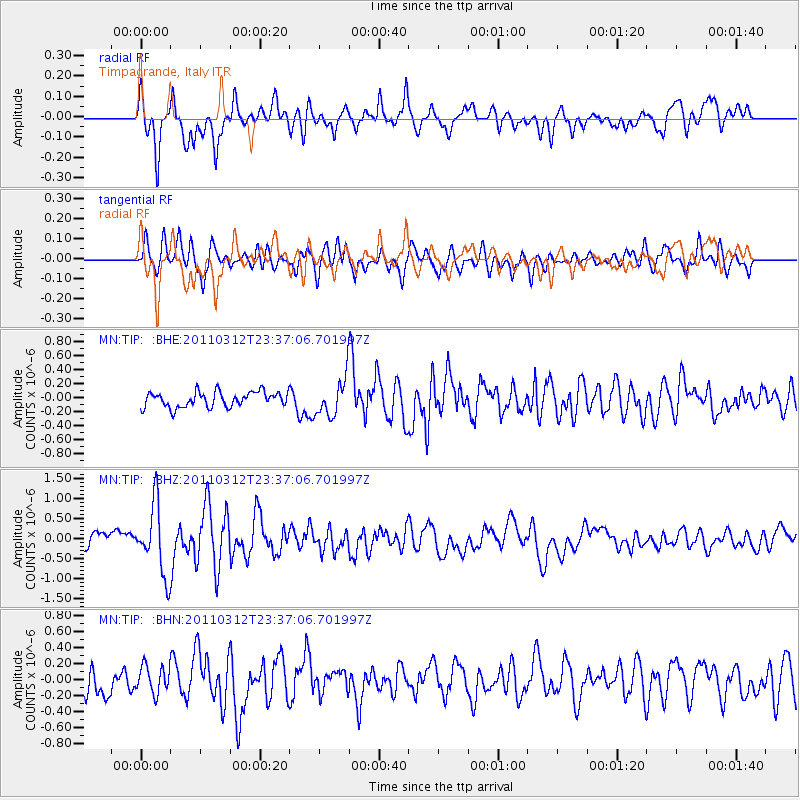
TIP Timpagrande, Italy - Earthquake Result Viewer
*The percent match for this event was below the threshold and hence no stack was calculated.
| Earthquake location: |
Near East Coast Of Honshu, Japan |
| Earthquake latitude/longitude: |
38.0/141.7 |
| Earthquake time(UTC): |
2011/03/12 (071) 23:24:48 GMT |
| Earthquake Depth: |
15 km |
| Earthquake Magnitude: |
6.0 MB, 5.6 MS, 6.1 MW, 5.9 MW |
| Earthquake Catalog/Contributor: |
WHDF/NEIC |
|
| Network: |
MN MEDNET Project |
| Station: |
TIP Timpagrande, Italy |
| Lat/Lon: |
39.18 N/16.76 E |
| Elevation: |
789 m |
|
| Distance: |
88.0 deg |
| Az: |
320.405 deg |
| Baz: |
40.347 deg |
| Ray Param: |
$rayparam |
*The percent match for this event was below the threshold and hence was not used in the summary stack. |
|
| Radial Match: |
74.3302 % |
| Radial Bump: |
400 |
| Transverse Match: |
66.965324 % |
| Transverse Bump: |
400 |
| SOD ConfigId: |
356183 |
| Insert Time: |
2011-08-20 13:16:07.698 +0000 |
| GWidth: |
2.5 |
| Max Bumps: |
400 |
| Tol: |
0.001 |
|
Signal To Noise
| Channel | StoN | STA | LTA |
| MN:TIP: :BHZ:20110312T23:37:06.701997Z | 5.494851 | 8.629314E-7 | 1.5704364E-7 |
| MN:TIP: :BHN:20110312T23:37:06.701997Z | 1.1308819 | 1.7225905E-7 | 1.5232276E-7 |
| MN:TIP: :BHE:20110312T23:37:06.701997Z | 2.4437683 | 2.6795158E-7 | 1.0964688E-7 |
| Arrivals |
| Ps | |
| PpPs | |
| PsPs/PpSs | |


