You are here: Home > Network List > TA - USArray Transportable Network (new EarthScope stations) Stations List
> Station MDND Maddock, ND, USA > Earthquake Result Viewer
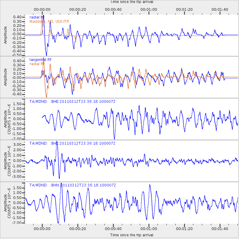
MDND Maddock, ND, USA - Earthquake Result Viewer
*The percent match for this event was below the threshold and hence no stack was calculated.
| Earthquake location: |
Near East Coast Of Honshu, Japan |
| Earthquake latitude/longitude: |
38.0/141.7 |
| Earthquake time(UTC): |
2011/03/12 (071) 23:24:48 GMT |
| Earthquake Depth: |
15 km |
| Earthquake Magnitude: |
6.0 MB, 5.6 MS, 6.1 MW, 5.9 MW |
| Earthquake Catalog/Contributor: |
WHDF/NEIC |
|
| Network: |
TA USArray Transportable Network (new EarthScope stations) |
| Station: |
MDND Maddock, ND, USA |
| Lat/Lon: |
47.85 N/99.60 W |
| Elevation: |
479 m |
|
| Distance: |
78.6 deg |
| Az: |
37.081 deg |
| Baz: |
315.031 deg |
| Ray Param: |
$rayparam |
*The percent match for this event was below the threshold and hence was not used in the summary stack. |
|
| Radial Match: |
77.346596 % |
| Radial Bump: |
341 |
| Transverse Match: |
72.77051 % |
| Transverse Bump: |
400 |
| SOD ConfigId: |
356183 |
| Insert Time: |
2011-08-20 13:23:59.751 +0000 |
| GWidth: |
2.5 |
| Max Bumps: |
400 |
| Tol: |
0.001 |
|
Signal To Noise
| Channel | StoN | STA | LTA |
| TA:MDND: :BHZ:20110312T23:36:18.100007Z | 2.4717379 | 5.457601E-7 | 2.2080016E-7 |
| TA:MDND: :BHN:20110312T23:36:18.100007Z | 1.7637347 | 4.957134E-7 | 2.8105893E-7 |
| TA:MDND: :BHE:20110312T23:36:18.100007Z | 1.2606528 | 5.751893E-7 | 4.5626305E-7 |
| Arrivals |
| Ps | |
| PpPs | |
| PsPs/PpSs | |


