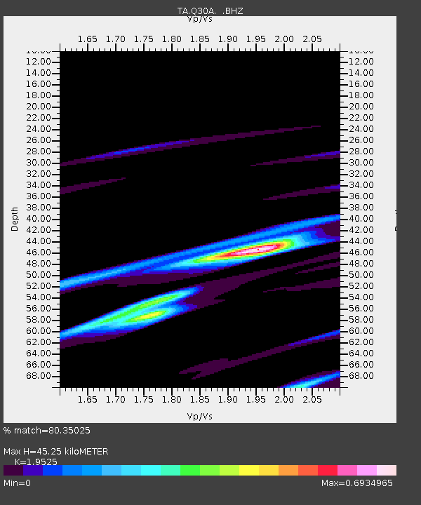
Q30A Quinter, KS, USA - Earthquake Result Viewer
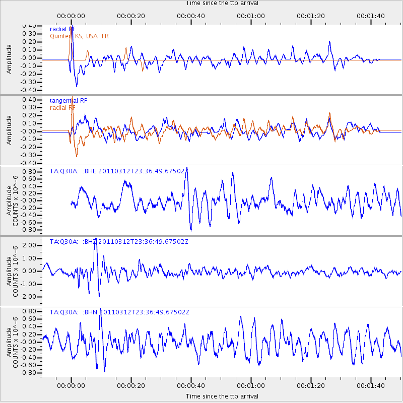
Earthquake location: Near East Coast Of Honshu, Japan
Earthquake latitude/longitude: 38.0/141.7
Earthquake time(UTC): 2011/03/12 (071) 23:24:48 GMT
Earthquake Depth: 15 km
Earthquake Magnitude: 6.0 MB, 5.6 MS, 6.1 MW, 5.9 MW
Earthquake Catalog/Contributor: WHDF/NEIC
Network: TA USArray Transportable Network (new EarthScope stations)
Station: Q30A Quinter, KS, USA
Lat/Lon: 38.98 N/100.22 W
Elevation: 797 m
Distance: 84.5 deg
Az: 43.707 deg
Baz: 315.583 deg
Ray Param: 0.045395218
Estimated Moho Depth: 45.25 km
Estimated Crust Vp/Vs: 1.95
Assumed Crust Vp: 6.483 km/s
Estimated Crust Vs: 3.32 km/s
Estimated Crust Poisson's Ratio: 0.32
Radial Match: 80.35025 %
Radial Bump: 400
Transverse Match: 61.349667 %
Transverse Bump: 400
SOD ConfigId: 356183
Insert Time: 2011-08-20 13:26:56.290 +0000
GWidth: 2.5
Max Bumps: 400
Tol: 0.001

Signal To Noise

ChannelStoNSTALTA
TA:Q30A: :BHZ:20110312T23:36:49.67502Z1.63634633.7007436E-72.2615895E-7
TA:Q30A: :BHN:20110312T23:36:49.67502Z1.58101512.661963E-71.683705E-7
TA:Q30A: :BHE:20110312T23:36:49.67502Z0.485790041.1937964E-72.4574325E-7
Arrivals
Ps6.8 SECOND
PpPs20 SECOND
PsPs/PpSs27 SECOND