I27A Quinn, SD, USA - Earthquake Result Viewer
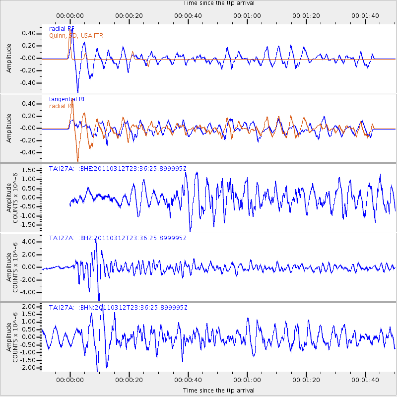
Earthquake location: Near East Coast Of Honshu, Japan
Earthquake latitude/longitude: 38.0/141.7
Earthquake time(UTC): 2011/03/12 (071) 23:24:48 GMT
Earthquake Depth: 15 km
Earthquake Magnitude: 6.0 MB, 5.6 MS, 6.1 MW, 5.9 MW
Earthquake Catalog/Contributor: WHDF/NEIC
Network: TA USArray Transportable Network (new EarthScope stations)
Station: I27A Quinn, SD, USA
Lat/Lon: 44.07 N/102.05 W
Elevation: 867 m
Distance: 80.0 deg
Az: 41.043 deg
Baz: 314.013 deg
Ray Param: 0.048576083
Estimated Moho Depth: 13.5 km
Estimated Crust Vp/Vs: 1.60
Assumed Crust Vp: 6.242 km/s
Estimated Crust Vs: 3.901 km/s
Estimated Crust Poisson's Ratio: 0.18
Radial Match: 80.542885 %
Radial Bump: 400
Transverse Match: 63.005436 %
Transverse Bump: 400
SOD ConfigId: 356183
Insert Time: 2011-08-20 13:31:21.781 +0000
GWidth: 2.5
Max Bumps: 400
Tol: 0.001

Signal To Noise

ChannelStoNSTALTA
TA:I27A: :BHZ:20110312T23:36:25.899995Z5.5895889.1269334E-71.6328454E-7
TA:I27A: :BHN:20110312T23:36:25.899995Z0.806368474.021989E-74.987781E-7
TA:I27A: :BHE:20110312T23:36:25.899995Z1.03378523.3691103E-73.259004E-7
Arrivals
Ps1.3 SECOND
PpPs5.5 SECOND
PsPs/PpSs6.8 SECOND